You are here: Home > Network List > TA - USArray Transportable Network (new EarthScope stations) Stations List
> Station K13A Stover Farm, Hazelton, ID, USA > Earthquake Result Viewer
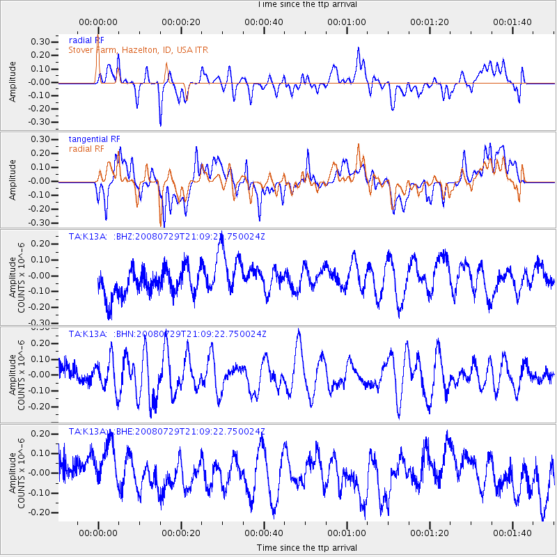
K13A Stover Farm, Hazelton, ID, USA - Earthquake Result Viewer
*The percent match for this event was below the threshold and hence no stack was calculated.
| Earthquake location: |
Southern East Pacific Rise |
| Earthquake latitude/longitude: |
-54.7/-118.8 |
| Earthquake time(UTC): |
2008/07/29 (211) 20:56:22 GMT |
| Earthquake Depth: |
10 km |
| Earthquake Magnitude: |
5.5 MB, 5.4 MS, 5.8 MW, 5.7 MW |
| Earthquake Catalog/Contributor: |
WHDF/NEIC |
|
| Network: |
TA USArray Transportable Network (new EarthScope stations) |
| Station: |
K13A Stover Farm, Hazelton, ID, USA |
| Lat/Lon: |
42.65 N/114.08 W |
| Elevation: |
1222 m |
|
| Distance: |
97.1 deg |
| Az: |
3.492 deg |
| Baz: |
182.745 deg |
| Ray Param: |
$rayparam |
*The percent match for this event was below the threshold and hence was not used in the summary stack. |
|
| Radial Match: |
48.883385 % |
| Radial Bump: |
400 |
| Transverse Match: |
49.760265 % |
| Transverse Bump: |
400 |
| SOD ConfigId: |
2504 |
| Insert Time: |
2010-03-07 06:02:45.992 +0000 |
| GWidth: |
2.5 |
| Max Bumps: |
400 |
| Tol: |
0.001 |
|
Signal To Noise
| Channel | StoN | STA | LTA |
| TA:K13A: :BHN:20080729T21:09:22.750024Z | 1.1279943 | 1.01987496E-7 | 9.04149E-8 |
| TA:K13A: :BHE:20080729T21:09:22.750024Z | 1.7474468 | 1.5232703E-7 | 8.71712E-8 |
| TA:K13A: :BHZ:20080729T21:09:22.750024Z | 2.0743058 | 1.679527E-7 | 8.096816E-8 |
| Arrivals |
| Ps | |
| PpPs | |
| PsPs/PpSs | |


