You are here: Home > Network List > TA - USArray Transportable Network (new EarthScope stations) Stations List
> Station 117A Oracle, AZ, USA > Earthquake Result Viewer
117A Oracle, AZ, USA - Earthquake Result Viewer

| Earthquake location: |
Near Coast Of Northern Chile |
| Earthquake latitude/longitude: |
-23.1/-70.6 |
| Earthquake time(UTC): |
2007/11/17 (321) 17:54:32 GMT |
| Earthquake Depth: |
15 km |
| Earthquake Magnitude: |
5.6 MB, 5.6 MS, 5.8 MW, 5.8 MW |
| Earthquake Catalog/Contributor: |
WHDF/NEIC |
|
| Network: |
TA USArray Transportable Network (new EarthScope stations) |
| Station: |
117A Oracle, AZ, USA |
| Lat/Lon: |
32.57 N/110.74 W |
| Elevation: |
1544 m |
|
| Distance: |
67.3 deg |
| Az: |
323.841 deg |
| Baz: |
139.938 deg |
| Ray Param: |
0.05703417 |
| Estimated Moho Depth: |
10.75 km |
| Estimated Crust Vp/Vs: |
1.86 |
| Assumed Crust Vp: |
6.276 km/s |
| Estimated Crust Vs: |
3.374 km/s |
| Estimated Crust Poisson's Ratio: |
0.30 |
|
| Radial Match: |
84.99485 % |
| Radial Bump: |
400 |
| Transverse Match: |
64.363335 % |
| Transverse Bump: |
400 |
| SOD ConfigId: |
2564 |
| Insert Time: |
2010-03-07 06:03:28.056 +0000 |
| GWidth: |
2.5 |
| Max Bumps: |
400 |
| Tol: |
0.001 |
|
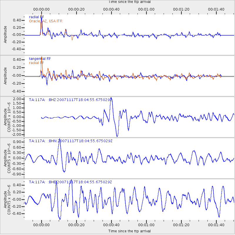
Signal To Noise
| Channel | StoN | STA | LTA |
| TA:117A: :BHN:20071117T18:04:55.675029Z | 0.96595997 | 1.4362794E-7 | 1.4868932E-7 |
| TA:117A: :BHE:20071117T18:04:55.675029Z | 0.79171944 | 1.2441427E-7 | 1.571444E-7 |
| TA:117A: :BHZ:20071117T18:04:55.675029Z | 3.5964134 | 2.9646506E-7 | 8.243354E-8 |
| Arrivals |
| Ps | 1.5 SECOND |
| PpPs | 4.7 SECOND |
| PsPs/PpSs | 6.3 SECOND |


