
117A Oracle, AZ, USA - Earthquake Result Viewer
| ||||||||||||||||||
| ||||||||||||||||||
| ||||||||||||||||||
|
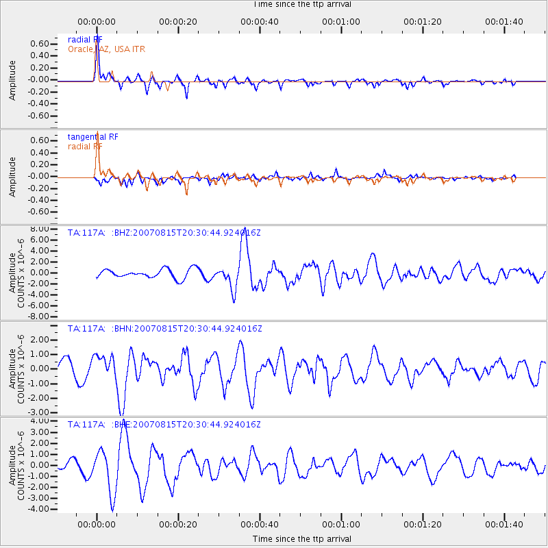
Signal To Noise
| Channel | StoN | STA | LTA |
| TA:117A: :BHN:20070815T20:30:44.924016Z | 1.2273238 | 7.866238E-7 | 6.409261E-7 |
| TA:117A: :BHE:20070815T20:30:44.924016Z | 1.985115 | 2.0017621E-6 | 1.0083859E-6 |
| TA:117A: :BHZ:20070815T20:30:44.924016Z | 2.517812 | 2.0952475E-6 | 8.3217E-7 |
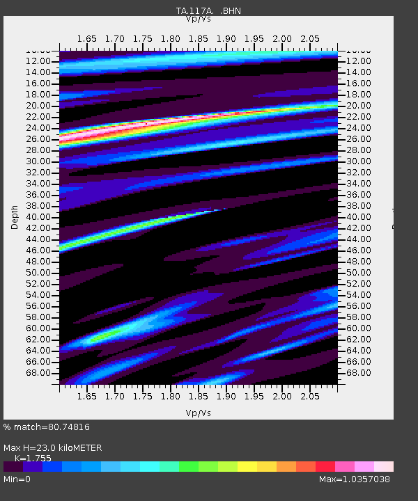
| Arrivals | |
| Ps | 2.9 SECOND |
| PpPs | 9.6 SECOND |
| PsPs/PpSs | 12 SECOND |

