117A Oracle, AZ, USA - Earthquake Result Viewer
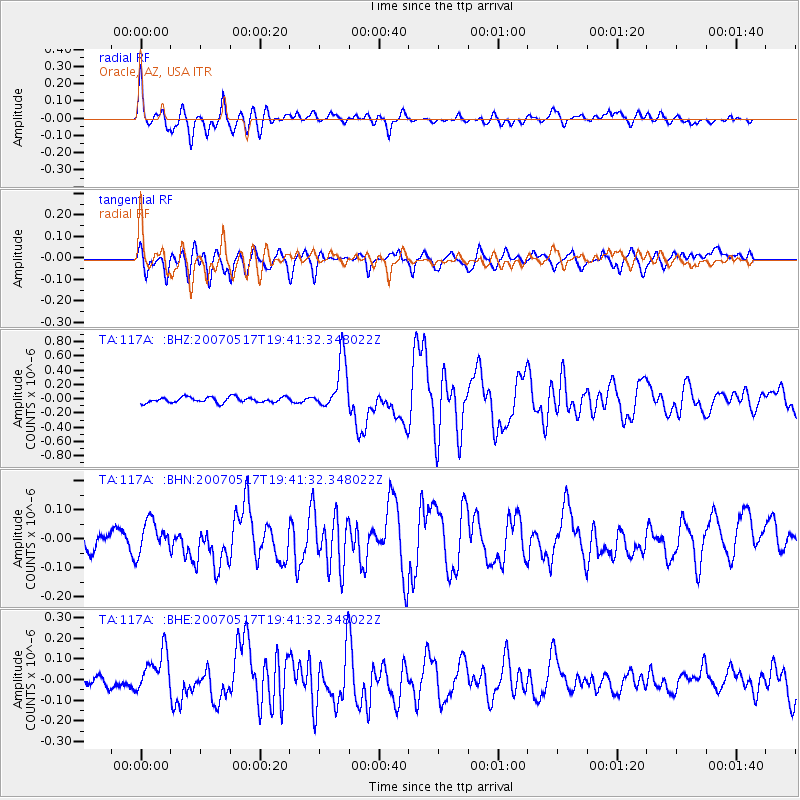
Earthquake location: Kermadec Islands, New Zealand
Earthquake latitude/longitude: -30.7/-178.2
Earthquake time(UTC): 2007/05/17 (137) 19:29:10 GMT
Earthquake Depth: 41 km
Earthquake Magnitude: 5.5 MB, 5.6 MS, 6.0 MW, 5.9 MW
Earthquake Catalog/Contributor: WHDF/NEIC
Network: TA USArray Transportable Network (new EarthScope stations)
Station: 117A Oracle, AZ, USA
Lat/Lon: 32.57 N/110.74 W
Elevation: 1544 m
Distance: 89.6 deg
Az: 51.25 deg
Baz: 232.743 deg
Ray Param: 0.04172768
Estimated Moho Depth: 33.25 km
Estimated Crust Vp/Vs: 1.71
Assumed Crust Vp: 6.276 km/s
Estimated Crust Vs: 3.675 km/s
Estimated Crust Poisson's Ratio: 0.24
Radial Match: 82.6904 %
Radial Bump: 400
Transverse Match: 75.19422 %
Transverse Bump: 400
SOD ConfigId: 2564
Insert Time: 2010-03-07 06:04:06.670 +0000
GWidth: 2.5
Max Bumps: 400
Tol: 0.001

Signal To Noise

ChannelStoNSTALTA
TA:117A: :BHN:20070517T19:41:32.348022Z1.43323035.315888E-83.7090256E-8
TA:117A: :BHE:20070517T19:41:32.348022Z2.98929269.761073E-83.2653453E-8
TA:117A: :BHZ:20070517T19:41:32.348022Z9.0695433.5424887E-73.9059177E-8
Arrivals
Ps3.8 SECOND
PpPs14 SECOND
PsPs/PpSs18 SECOND