117A Oracle, AZ, USA - Earthquake Result Viewer
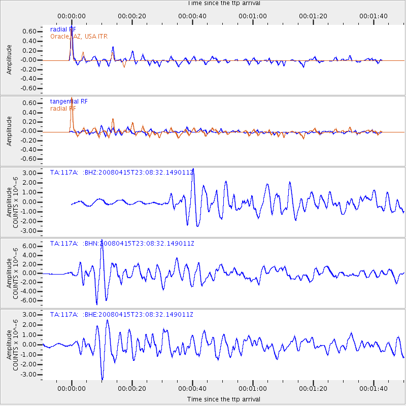
Earthquake location: Andreanof Islands, Aleutian Is.
Earthquake latitude/longitude: 51.9/-179.4
Earthquake time(UTC): 2008/04/15 (106) 22:59:51 GMT
Earthquake Depth: 10 km
Earthquake Magnitude: 6.1 MB, 6.4 MS, 6.4 MW, 6.4 MW
Earthquake Catalog/Contributor: WHDF/NEIC
Network: TA USArray Transportable Network (new EarthScope stations)
Station: 117A Oracle, AZ, USA
Lat/Lon: 32.57 N/110.74 W
Elevation: 1544 m
Distance: 52.3 deg
Az: 83.409 deg
Baz: 313.138 deg
Ray Param: 0.066832855
Estimated Moho Depth: 43.75 km
Estimated Crust Vp/Vs: 2.04
Assumed Crust Vp: 6.276 km/s
Estimated Crust Vs: 3.073 km/s
Estimated Crust Poisson's Ratio: 0.34
Radial Match: 94.68006 %
Radial Bump: 329
Transverse Match: 89.38808 %
Transverse Bump: 400
SOD ConfigId: 2504
Insert Time: 2010-03-07 06:04:09.531 +0000
GWidth: 2.5
Max Bumps: 400
Tol: 0.001

Signal To Noise

ChannelStoNSTALTA
TA:117A: :BHN:20080415T23:08:32.149011Z7.44899751.1317234E-61.5192963E-7
TA:117A: :BHE:20080415T23:08:32.149011Z2.14984133.978033E-71.8503846E-7
TA:117A: :BHZ:20080415T23:08:32.149011Z1.92684693.7331662E-71.9374482E-7
Arrivals
Ps7.6 SECOND
PpPs20 SECOND
PsPs/PpSs28 SECOND