You are here: Home > Network List > GS - US Geological Survey Networks Stations List
> Station DEC08 Decatur Surface Seismic Site, Decatur, IL, USA > Earthquake Result Viewer
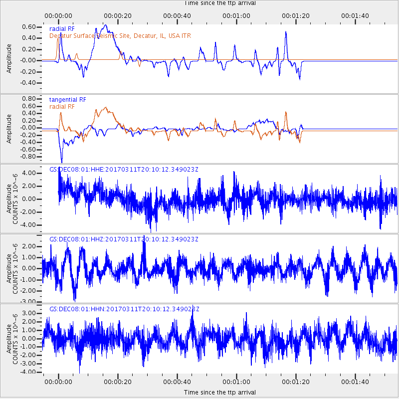
DEC08 Decatur Surface Seismic Site, Decatur, IL, USA - Earthquake Result Viewer
*The percent match for this event was below the threshold and hence no stack was calculated.
| Earthquake location: |
Near East Coast Of Honshu, Japan |
| Earthquake latitude/longitude: |
37.5/141.5 |
| Earthquake time(UTC): |
2017/03/11 (070) 19:57:48 GMT |
| Earthquake Depth: |
44 km |
| Earthquake Magnitude: |
5.3 Mww |
| Earthquake Catalog/Contributor: |
NEIC PDE/us |
|
| Network: |
GS US Geological Survey Networks |
| Station: |
DEC08 Decatur Surface Seismic Site, Decatur, IL, USA |
| Lat/Lon: |
39.86 N/88.92 W |
| Elevation: |
210 m |
|
| Distance: |
90.1 deg |
| Az: |
36.399 deg |
| Baz: |
322.2 deg |
| Ray Param: |
$rayparam |
*The percent match for this event was below the threshold and hence was not used in the summary stack. |
|
| Radial Match: |
39.787617 % |
| Radial Bump: |
400 |
| Transverse Match: |
48.23306 % |
| Transverse Bump: |
400 |
| SOD ConfigId: |
1992691 |
| Insert Time: |
2017-03-25 19:59:16.703 +0000 |
| GWidth: |
2.5 |
| Max Bumps: |
400 |
| Tol: |
0.001 |
|
Signal To Noise
| Channel | StoN | STA | LTA |
| GS:DEC08:01:HHZ:20170311T20:10:12.349023Z | 1.5245777 | 1.1461008E-6 | 7.5174967E-7 |
| GS:DEC08:01:HHN:20170311T20:10:12.349023Z | 0.80474776 | 9.120796E-7 | 1.1333732E-6 |
| GS:DEC08:01:HHE:20170311T20:10:12.349023Z | 2.0403476 | 2.518223E-6 | 1.2342127E-6 |
| Arrivals |
| Ps | |
| PpPs | |
| PsPs/PpSs | |


