You are here: Home > Network List > CN - Canadian National Seismograph Network Stations List
> Station INK INUVIK, NT > Earthquake Result Viewer
INK INUVIK, NT - Earthquake Result Viewer
*The percent match for this event was below the threshold and hence no stack was calculated.
| Earthquake location: |
Sea Of Okhotsk |
| Earthquake latitude/longitude: |
53.2/153.7 |
| Earthquake time(UTC): |
2019/11/20 (324) 08:26:07 GMT |
| Earthquake Depth: |
487 km |
| Earthquake Magnitude: |
6.3 Mww |
| Earthquake Catalog/Contributor: |
NEIC PDE/us |
|
| Network: |
CN Canadian National Seismograph Network |
| Station: |
INK INUVIK, NT |
| Lat/Lon: |
68.31 N/133.53 W |
| Elevation: |
44 m |
|
| Distance: |
36.2 deg |
| Az: |
37.01 deg |
| Baz: |
282.874 deg |
| Ray Param: |
$rayparam |
*The percent match for this event was below the threshold and hence was not used in the summary stack. |
|
| Radial Match: |
73.311584 % |
| Radial Bump: |
357 |
| Transverse Match: |
54.149296 % |
| Transverse Bump: |
400 |
| SOD ConfigId: |
19951751 |
| Insert Time: |
2019-12-04 08:31:18.065 +0000 |
| GWidth: |
2.5 |
| Max Bumps: |
400 |
| Tol: |
0.001 |
|
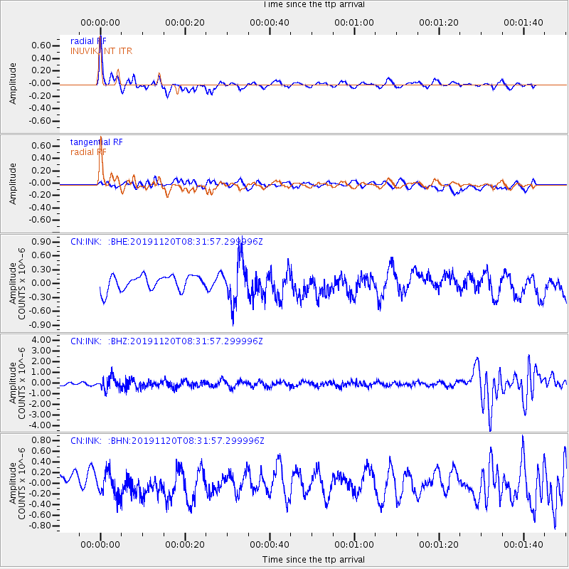
Signal To Noise
| Channel | StoN | STA | LTA |
| CN:INK: :BHZ:20191120T08:31:57.299996Z | 3.067462 | 5.7477166E-7 | 1.8737694E-7 |
| CN:INK: :BHN:20191120T08:31:57.299996Z | 1.1223954 | 2.1667533E-7 | 1.9304724E-7 |
| CN:INK: :BHE:20191120T08:31:57.299996Z | 2.7562284 | 4.4367746E-7 | 1.6097268E-7 |
| Arrivals |
| Ps | |
| PpPs | |
| PsPs/PpSs | |


