You are here: Home > Network List > TS - TERRAscope (Southern California Seismic Network) Stations List
> Station PAS Pasadena, California, USA > Earthquake Result Viewer
PAS Pasadena, California, USA - Earthquake Result Viewer

| Earthquake location: |
Hokkaido, Japan Region |
| Earthquake latitude/longitude: |
43.4/143.3 |
| Earthquake time(UTC): |
1993/01/15 (015) 11:06:05 GMT |
| Earthquake Depth: |
100 km |
| Earthquake Magnitude: |
6.9 MB, 7.1 MS |
| Earthquake Catalog/Contributor: |
WHDF/NEIC |
|
| Network: |
TS TERRAscope (Southern California Seismic Network) |
| Station: |
PAS Pasadena, California, USA |
| Lat/Lon: |
34.15 N/118.17 W |
| Elevation: |
295 m |
|
| Distance: |
73.0 deg |
| Az: |
59.046 deg |
| Baz: |
311.091 deg |
| Ray Param: |
0.05306006 |
| Estimated Moho Depth: |
26.5 km |
| Estimated Crust Vp/Vs: |
1.79 |
| Assumed Crust Vp: |
6.1 km/s |
| Estimated Crust Vs: |
3.403 km/s |
| Estimated Crust Poisson's Ratio: |
0.27 |
|
| Radial Match: |
96.09378 % |
| Radial Bump: |
400 |
| Transverse Match: |
87.52967 % |
| Transverse Bump: |
400 |
| SOD ConfigId: |
16938 |
| Insert Time: |
2010-02-26 14:35:13.774 +0000 |
| GWidth: |
2.5 |
| Max Bumps: |
400 |
| Tol: |
0.001 |
|
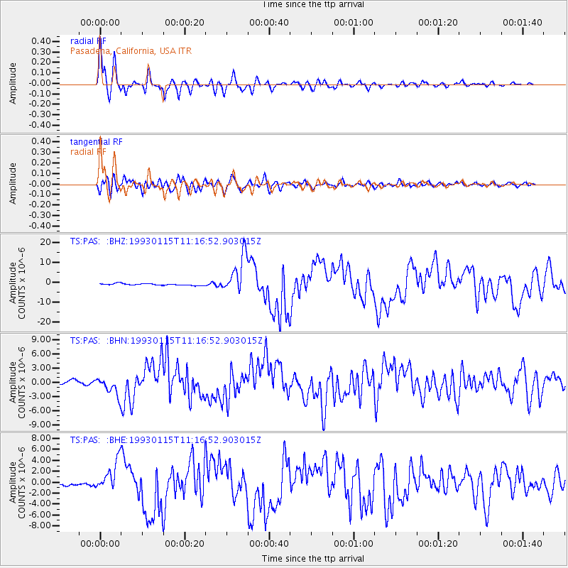
Signal To Noise
| Channel | StoN | STA | LTA |
| TS:PAS: :BHN:19930115T11:16:52.903015Z | 6.265446 | 1.9777724E-6 | 3.1566347E-7 |
| TS:PAS: :BHE:19930115T11:16:52.903015Z | 12.030334 | 2.9132784E-6 | 2.4216104E-7 |
| TS:PAS: :BHZ:19930115T11:16:52.903015Z | 23.628944 | 9.953967E-6 | 4.212616E-7 |
| Arrivals |
| Ps | 3.5 SECOND |
| PpPs | 12 SECOND |
| PsPs/PpSs | 15 SECOND |


