You are here: Home > Network List > IU - Global Seismograph Network (GSN - IRIS/USGS) Stations List
> Station RSSD Black Hills, South Dakota, USA > Earthquake Result Viewer
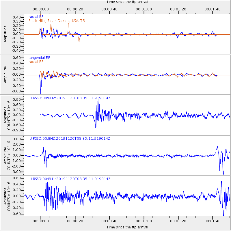
RSSD Black Hills, South Dakota, USA - Earthquake Result Viewer
*The percent match for this event was below the threshold and hence no stack was calculated.
| Earthquake location: |
Sea Of Okhotsk |
| Earthquake latitude/longitude: |
53.2/153.7 |
| Earthquake time(UTC): |
2019/11/20 (324) 08:26:07 GMT |
| Earthquake Depth: |
487 km |
| Earthquake Magnitude: |
6.3 Mww |
| Earthquake Catalog/Contributor: |
NEIC PDE/us |
|
| Network: |
IU Global Seismograph Network (GSN - IRIS/USGS) |
| Station: |
RSSD Black Hills, South Dakota, USA |
| Lat/Lon: |
44.12 N/104.04 W |
| Elevation: |
2090 m |
|
| Distance: |
62.5 deg |
| Az: |
52.499 deg |
| Baz: |
318.451 deg |
| Ray Param: |
$rayparam |
*The percent match for this event was below the threshold and hence was not used in the summary stack. |
|
| Radial Match: |
67.83946 % |
| Radial Bump: |
400 |
| Transverse Match: |
91.69965 % |
| Transverse Bump: |
376 |
| SOD ConfigId: |
19951751 |
| Insert Time: |
2019-12-04 08:32:57.889 +0000 |
| GWidth: |
2.5 |
| Max Bumps: |
400 |
| Tol: |
0.001 |
|
Signal To Noise
| Channel | StoN | STA | LTA |
| IU:RSSD:00:BHZ:20191120T08:35:11.919014Z | 7.709025 | 6.3389655E-7 | 8.222785E-8 |
| IU:RSSD:00:BH1:20191120T08:35:11.919014Z | 2.890269 | 2.128499E-7 | 7.3643626E-8 |
| IU:RSSD:00:BH2:20191120T08:35:11.919014Z | 4.9751797 | 3.634811E-7 | 7.3058885E-8 |
| Arrivals |
| Ps | |
| PpPs | |
| PsPs/PpSs | |


