You are here: Home > Network List > TA - USArray Transportable Network (new EarthScope stations) Stations List
> Station H31M Peel River, Yukon, CAN > Earthquake Result Viewer
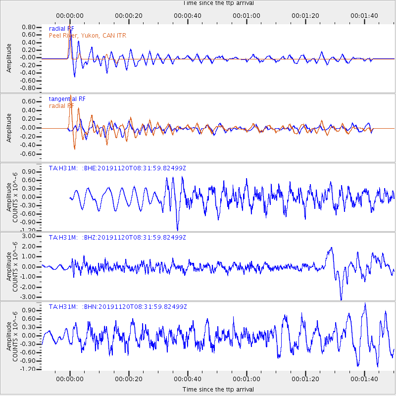
H31M Peel River, Yukon, CAN - Earthquake Result Viewer
*The percent match for this event was below the threshold and hence no stack was calculated.
| Earthquake location: |
Sea Of Okhotsk |
| Earthquake latitude/longitude: |
53.2/153.7 |
| Earthquake time(UTC): |
2019/11/20 (324) 08:26:07 GMT |
| Earthquake Depth: |
487 km |
| Earthquake Magnitude: |
6.3 Mww |
| Earthquake Catalog/Contributor: |
NEIC PDE/us |
|
| Network: |
TA USArray Transportable Network (new EarthScope stations) |
| Station: |
H31M Peel River, Yukon, CAN |
| Lat/Lon: |
65.81 N/134.34 W |
| Elevation: |
642 m |
|
| Distance: |
36.5 deg |
| Az: |
41.257 deg |
| Baz: |
285.545 deg |
| Ray Param: |
$rayparam |
*The percent match for this event was below the threshold and hence was not used in the summary stack. |
|
| Radial Match: |
68.73502 % |
| Radial Bump: |
400 |
| Transverse Match: |
48.881443 % |
| Transverse Bump: |
400 |
| SOD ConfigId: |
19951751 |
| Insert Time: |
2019-12-04 08:37:06.980 +0000 |
| GWidth: |
2.5 |
| Max Bumps: |
400 |
| Tol: |
0.001 |
|
Signal To Noise
| Channel | StoN | STA | LTA |
| TA:H31M: :BHZ:20191120T08:31:59.82499Z | 2.3097892 | 4.5359297E-7 | 1.9637852E-7 |
| TA:H31M: :BHN:20191120T08:31:59.82499Z | 1.2933646 | 2.8873416E-7 | 2.2324265E-7 |
| TA:H31M: :BHE:20191120T08:31:59.82499Z | 1.2791234 | 3.2473267E-7 | 2.5387124E-7 |
| Arrivals |
| Ps | |
| PpPs | |
| PsPs/PpSs | |


