You are here: Home > Network List > TA - USArray Transportable Network (new EarthScope stations) Stations List
> Station Z15A Gila River Indian Community, Laveen, AZ, USA > Earthquake Result Viewer
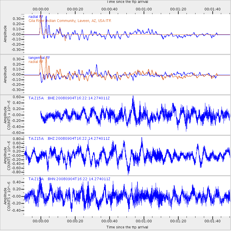
Z15A Gila River Indian Community, Laveen, AZ, USA - Earthquake Result Viewer
*The percent match for this event was below the threshold and hence no stack was calculated.
| Earthquake location: |
Kermadec Islands Region |
| Earthquake latitude/longitude: |
-31.6/-177.8 |
| Earthquake time(UTC): |
2008/09/04 (248) 16:09:51 GMT |
| Earthquake Depth: |
26 km |
| Earthquake Magnitude: |
5.5 MB, 5.9 MS, 5.8 MW, 5.7 MW |
| Earthquake Catalog/Contributor: |
WHDF/NEIC |
|
| Network: |
TA USArray Transportable Network (new EarthScope stations) |
| Station: |
Z15A Gila River Indian Community, Laveen, AZ, USA |
| Lat/Lon: |
33.29 N/112.16 W |
| Elevation: |
318 m |
|
| Distance: |
89.4 deg |
| Az: |
49.74 deg |
| Baz: |
231.058 deg |
| Ray Param: |
$rayparam |
*The percent match for this event was below the threshold and hence was not used in the summary stack. |
|
| Radial Match: |
55.980072 % |
| Radial Bump: |
400 |
| Transverse Match: |
63.25451 % |
| Transverse Bump: |
400 |
| SOD ConfigId: |
2504 |
| Insert Time: |
2010-03-07 06:06:17.741 +0000 |
| GWidth: |
2.5 |
| Max Bumps: |
400 |
| Tol: |
0.001 |
|
Signal To Noise
| Channel | StoN | STA | LTA |
| TA:Z15A: :BHZ:20080904T16:22:14.274011Z | 1.5238237 | 2.3555302E-7 | 1.5458022E-7 |
| TA:Z15A: :BHN:20080904T16:22:14.274011Z | 1.8741452 | 1.9162471E-7 | 1.0224646E-7 |
| TA:Z15A: :BHE:20080904T16:22:14.274011Z | 1.5870262 | 1.6155386E-7 | 1.0179659E-7 |
| Arrivals |
| Ps | |
| PpPs | |
| PsPs/PpSs | |


