You are here: Home > Network List > US - United States National Seismic Network Stations List
> Station DGMT Dagmar, Montana, USA > Earthquake Result Viewer
DGMT Dagmar, Montana, USA - Earthquake Result Viewer
*The percent match for this event was below the threshold and hence no stack was calculated.
| Earthquake location: |
Sea Of Okhotsk |
| Earthquake latitude/longitude: |
53.2/153.7 |
| Earthquake time(UTC): |
2019/11/20 (324) 08:26:07 GMT |
| Earthquake Depth: |
487 km |
| Earthquake Magnitude: |
6.3 Mww |
| Earthquake Catalog/Contributor: |
NEIC PDE/us |
|
| Network: |
US United States National Seismic Network |
| Station: |
DGMT Dagmar, Montana, USA |
| Lat/Lon: |
48.47 N/104.20 W |
| Elevation: |
0.0 m |
|
| Distance: |
59.2 deg |
| Az: |
49.234 deg |
| Baz: |
316.745 deg |
| Ray Param: |
$rayparam |
*The percent match for this event was below the threshold and hence was not used in the summary stack. |
|
| Radial Match: |
74.93026 % |
| Radial Bump: |
370 |
| Transverse Match: |
51.88882 % |
| Transverse Bump: |
400 |
| SOD ConfigId: |
19951751 |
| Insert Time: |
2019-12-04 08:38:21.331 +0000 |
| GWidth: |
2.5 |
| Max Bumps: |
400 |
| Tol: |
0.001 |
|
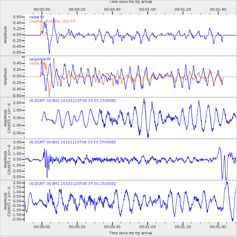
Signal To Noise
| Channel | StoN | STA | LTA |
| US:DGMT:00:BHZ:20191120T08:34:50.250008Z | 4.735166 | 9.600147E-7 | 2.0274153E-7 |
| US:DGMT:00:BH1:20191120T08:34:50.250008Z | 0.7078829 | 5.067826E-7 | 7.1591313E-7 |
| US:DGMT:00:BH2:20191120T08:34:50.250008Z | 1.0352715 | 6.3606126E-7 | 6.143908E-7 |
| Arrivals |
| Ps | |
| PpPs | |
| PsPs/PpSs | |


