You are here: Home > Network List > US - United States National Seismic Network Stations List
> Station GLMI Grayling, Michigan, USA > Earthquake Result Viewer
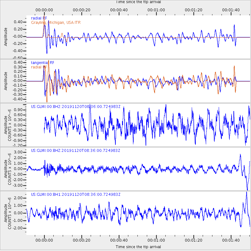
GLMI Grayling, Michigan, USA - Earthquake Result Viewer
*The percent match for this event was below the threshold and hence no stack was calculated.
| Earthquake location: |
Sea Of Okhotsk |
| Earthquake latitude/longitude: |
53.2/153.7 |
| Earthquake time(UTC): |
2019/11/20 (324) 08:26:07 GMT |
| Earthquake Depth: |
487 km |
| Earthquake Magnitude: |
6.3 Mww |
| Earthquake Catalog/Contributor: |
NEIC PDE/us |
|
| Network: |
US United States National Seismic Network |
| Station: |
GLMI Grayling, Michigan, USA |
| Lat/Lon: |
44.82 N/84.62 W |
| Elevation: |
387 m |
|
| Distance: |
70.4 deg |
| Az: |
40.001 deg |
| Baz: |
327.052 deg |
| Ray Param: |
$rayparam |
*The percent match for this event was below the threshold and hence was not used in the summary stack. |
|
| Radial Match: |
45.801926 % |
| Radial Bump: |
400 |
| Transverse Match: |
50.57863 % |
| Transverse Bump: |
400 |
| SOD ConfigId: |
19951751 |
| Insert Time: |
2019-12-04 08:38:24.380 +0000 |
| GWidth: |
2.5 |
| Max Bumps: |
400 |
| Tol: |
0.001 |
|
Signal To Noise
| Channel | StoN | STA | LTA |
| US:GLMI:00:BHZ:20191120T08:36:00.724983Z | 2.3077154 | 6.076979E-7 | 2.6333313E-7 |
| US:GLMI:00:BH1:20191120T08:36:00.724983Z | 1.0438809 | 4.1555185E-7 | 3.9808359E-7 |
| US:GLMI:00:BH2:20191120T08:36:00.724983Z | 1.0415351 | 3.931184E-7 | 3.7744132E-7 |
| Arrivals |
| Ps | |
| PpPs | |
| PsPs/PpSs | |


