You are here: Home > Network List > US - United States National Seismic Network Stations List
> Station HAWA Hanford, Washington, USA > Earthquake Result Viewer
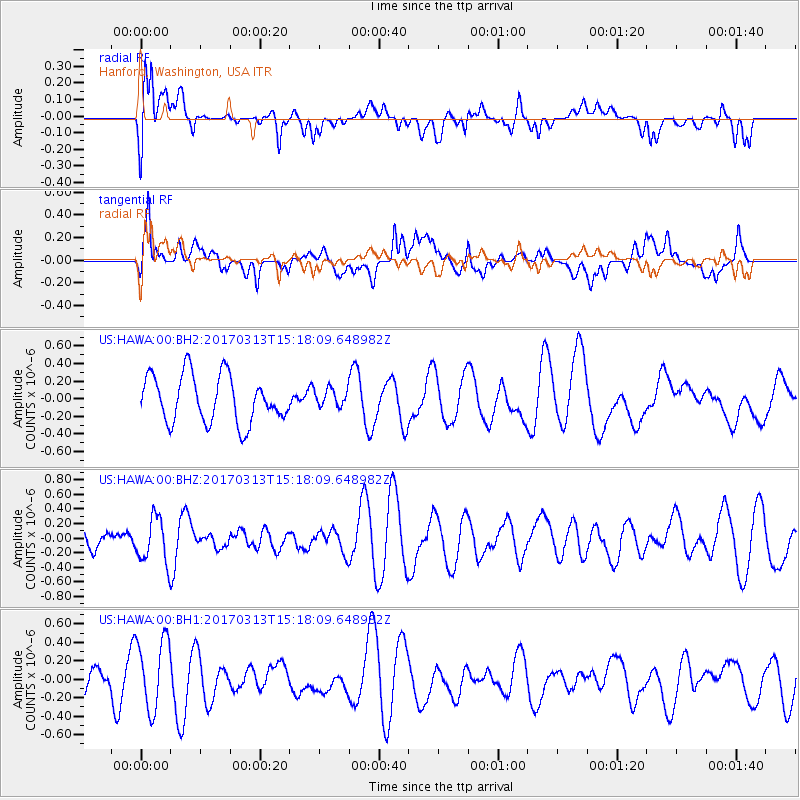
HAWA Hanford, Washington, USA - Earthquake Result Viewer
*The percent match for this event was below the threshold and hence no stack was calculated.
| Earthquake location: |
Near Coast Of Central Chile |
| Earthquake latitude/longitude: |
-30.4/-71.5 |
| Earthquake time(UTC): |
2017/03/13 (072) 15:05:55 GMT |
| Earthquake Depth: |
42 km |
| Earthquake Magnitude: |
5.3 mb |
| Earthquake Catalog/Contributor: |
NEIC PDE/us |
|
| Network: |
US United States National Seismic Network |
| Station: |
HAWA Hanford, Washington, USA |
| Lat/Lon: |
46.39 N/119.53 W |
| Elevation: |
364 m |
|
| Distance: |
88.0 deg |
| Az: |
328.984 deg |
| Baz: |
139.981 deg |
| Ray Param: |
$rayparam |
*The percent match for this event was below the threshold and hence was not used in the summary stack. |
|
| Radial Match: |
50.098385 % |
| Radial Bump: |
400 |
| Transverse Match: |
65.59999 % |
| Transverse Bump: |
400 |
| SOD ConfigId: |
1992691 |
| Insert Time: |
2017-03-27 15:10:07.305 +0000 |
| GWidth: |
2.5 |
| Max Bumps: |
400 |
| Tol: |
0.001 |
|
Signal To Noise
| Channel | StoN | STA | LTA |
| US:HAWA:00:BHZ:20170313T15:18:09.648982Z | 1.4223413 | 3.1069635E-7 | 2.1844006E-7 |
| US:HAWA:00:BH1:20170313T15:18:09.648982Z | 2.0278623 | 3.8822566E-7 | 1.9144576E-7 |
| US:HAWA:00:BH2:20170313T15:18:09.648982Z | 0.3752309 | 1.0005061E-7 | 2.6663744E-7 |
| Arrivals |
| Ps | |
| PpPs | |
| PsPs/PpSs | |


