You are here: Home > Network List > TA - USArray Transportable Network (new EarthScope stations) Stations List
> Station D23K Nanushuk River, AK USA > Earthquake Result Viewer
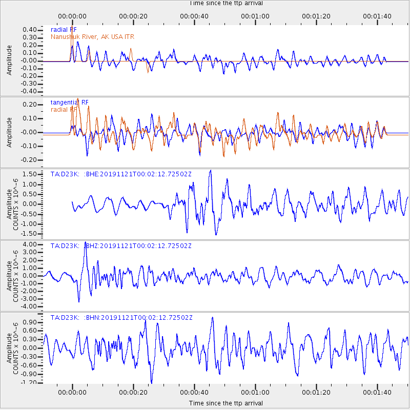
D23K Nanushuk River, AK USA - Earthquake Result Viewer
*The percent match for this event was below the threshold and hence no stack was calculated.
| Earthquake location: |
Laos |
| Earthquake latitude/longitude: |
19.5/101.3 |
| Earthquake time(UTC): |
2019/11/20 (324) 23:50:44 GMT |
| Earthquake Depth: |
10 km |
| Earthquake Magnitude: |
6.1 Mww |
| Earthquake Catalog/Contributor: |
NEIC PDE/us |
|
| Network: |
TA USArray Transportable Network (new EarthScope stations) |
| Station: |
D23K Nanushuk River, AK USA |
| Lat/Lon: |
68.97 N/150.68 W |
| Elevation: |
406 m |
|
| Distance: |
78.3 deg |
| Az: |
20.534 deg |
| Baz: |
293.542 deg |
| Ray Param: |
$rayparam |
*The percent match for this event was below the threshold and hence was not used in the summary stack. |
|
| Radial Match: |
62.20182 % |
| Radial Bump: |
400 |
| Transverse Match: |
63.113388 % |
| Transverse Bump: |
400 |
| SOD ConfigId: |
19951751 |
| Insert Time: |
2019-12-05 00:00:43.391 +0000 |
| GWidth: |
2.5 |
| Max Bumps: |
400 |
| Tol: |
0.001 |
|
Signal To Noise
| Channel | StoN | STA | LTA |
| TA:D23K: :BHZ:20191121T00:02:12.72502Z | 4.5630903 | 1.8910633E-6 | 4.1442598E-7 |
| TA:D23K: :BHN:20191121T00:02:12.72502Z | 0.9410819 | 2.9151647E-7 | 3.097674E-7 |
| TA:D23K: :BHE:20191121T00:02:12.72502Z | 1.2662767 | 2.9296933E-7 | 2.3136279E-7 |
| Arrivals |
| Ps | |
| PpPs | |
| PsPs/PpSs | |


