G26A Maurine, SD, USA - Earthquake Result Viewer
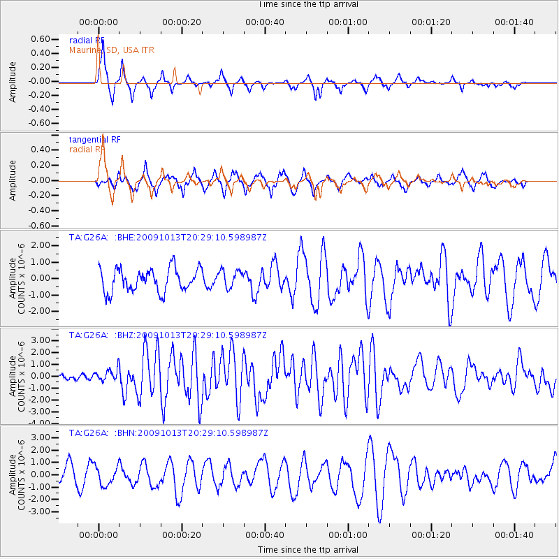
Earthquake location: Fox Islands, Aleutian Islands
Earthquake latitude/longitude: 52.6/-167.1
Earthquake time(UTC): 2009/10/13 (286) 20:21:53 GMT
Earthquake Depth: 14 km
Earthquake Magnitude: 5.9 MB, 6.4 MS, 6.4 MW, 6.4 MW
Earthquake Catalog/Contributor: WHDF/NEIC
Network: TA USArray Transportable Network (new EarthScope stations)
Station: G26A Maurine, SD, USA
Lat/Lon: 45.29 N/102.60 W
Elevation: 833 m
Distance: 41.7 deg
Az: 73.283 deg
Baz: 304.154 deg
Ray Param: 0.07361166
Estimated Moho Depth: 55.25 km
Estimated Crust Vp/Vs: 1.60
Assumed Crust Vp: 6.242 km/s
Estimated Crust Vs: 3.901 km/s
Estimated Crust Poisson's Ratio: 0.18
Radial Match: 80.62516 %
Radial Bump: 337
Transverse Match: 69.03077 %
Transverse Bump: 400
SOD ConfigId: 2622
Insert Time: 2010-03-07 06:08:48.039 +0000
GWidth: 2.5
Max Bumps: 400
Tol: 0.001

Signal To Noise

ChannelStoNSTALTA
TA:G26A: :BHZ:20091013T20:29:10.598987Z2.32966355.137718E-72.2053476E-7
TA:G26A: :BHN:20091013T20:29:10.598987Z1.34480547.5403887E-75.6070485E-7
TA:G26A: :BHE:20091013T20:29:10.598987Z0.75526025.286573E-76.999671E-7
Arrivals
Ps5.7 SECOND
PpPs21 SECOND
PsPs/PpSs27 SECOND