You are here: Home > Network List > TA - USArray Transportable Network (new EarthScope stations) Stations List
> Station E27A Carson, ND, USA > Earthquake Result Viewer
E27A Carson, ND, USA - Earthquake Result Viewer

| Earthquake location: |
Samoa Islands Region |
| Earthquake latitude/longitude: |
-16.2/-173.0 |
| Earthquake time(UTC): |
2009/09/29 (272) 18:21:42 GMT |
| Earthquake Depth: |
10 km |
| Earthquake Magnitude: |
5.8 MB |
| Earthquake Catalog/Contributor: |
WHDF/NEIC |
|
| Network: |
TA USArray Transportable Network (new EarthScope stations) |
| Station: |
E27A Carson, ND, USA |
| Lat/Lon: |
46.43 N/101.56 W |
| Elevation: |
738 m |
|
| Distance: |
89.3 deg |
| Az: |
40.968 deg |
| Baz: |
245.603 deg |
| Ray Param: |
0.04192144 |
| Estimated Moho Depth: |
10.25 km |
| Estimated Crust Vp/Vs: |
1.60 |
| Assumed Crust Vp: |
6.438 km/s |
| Estimated Crust Vs: |
4.023 km/s |
| Estimated Crust Poisson's Ratio: |
0.18 |
|
| Radial Match: |
95.445145 % |
| Radial Bump: |
371 |
| Transverse Match: |
33.619305 % |
| Transverse Bump: |
400 |
| SOD ConfigId: |
2622 |
| Insert Time: |
2010-03-07 06:09:56.455 +0000 |
| GWidth: |
2.5 |
| Max Bumps: |
400 |
| Tol: |
0.001 |
|
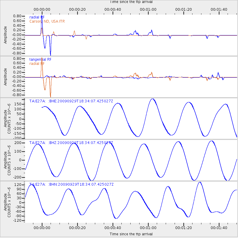
Signal To Noise
| Channel | StoN | STA | LTA |
| TA:E27A: :BHZ:20090929T18:34:07.425027Z | 0.8239118 | 1.0250735E-4 | 1.2441544E-4 |
| TA:E27A: :BHN:20090929T18:34:07.425027Z | 0.833271 | 7.888088E-5 | 9.466413E-5 |
| TA:E27A: :BHE:20090929T18:34:07.425027Z | 1.3963108 | 1.450923E-4 | 1.0391118E-4 |
| Arrivals |
| Ps | 1.0 SECOND |
| PpPs | 4.0 SECOND |
| PsPs/PpSs | 5.0 SECOND |


