You are here: Home > Network List > G - GEOSCOPE Stations List
> Station WUS Wushi, Xinjiang Uygur, China > Earthquake Result Viewer
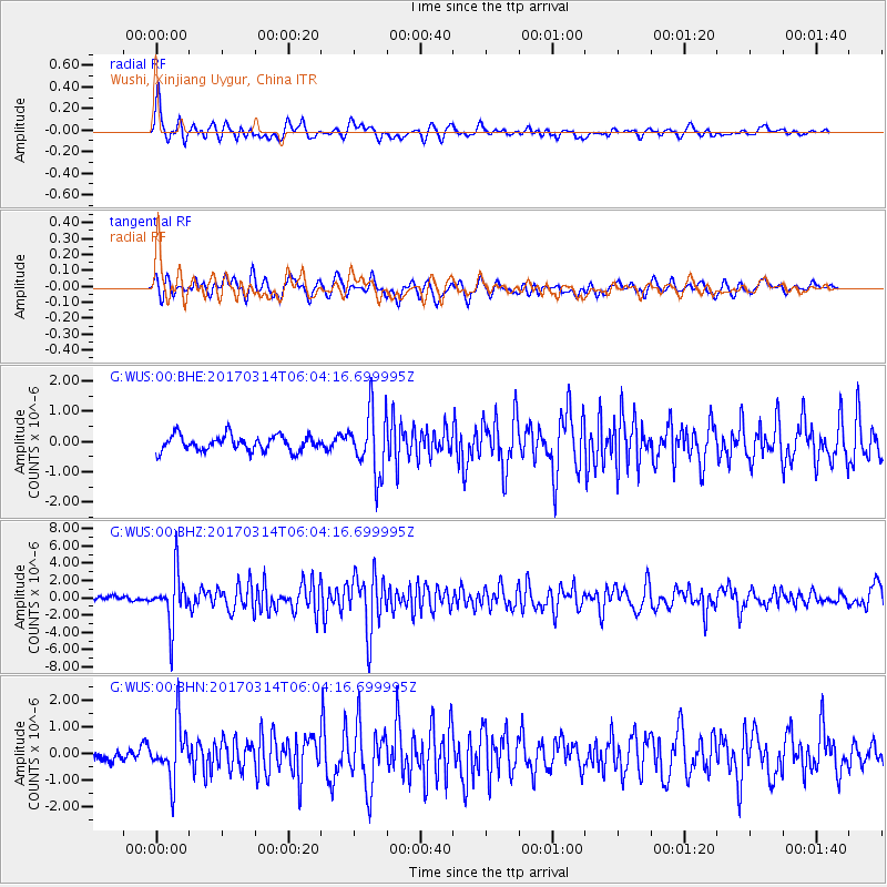
WUS Wushi, Xinjiang Uygur, China - Earthquake Result Viewer
*The percent match for this event was below the threshold and hence no stack was calculated.
| Earthquake location: |
Minahassa Peninsula, Sulawesi |
| Earthquake latitude/longitude: |
0.7/121.2 |
| Earthquake time(UTC): |
2017/03/14 (073) 05:55:21 GMT |
| Earthquake Depth: |
79 km |
| Earthquake Magnitude: |
5.6 mb |
| Earthquake Catalog/Contributor: |
NEIC PDE/us |
|
| Network: |
G GEOSCOPE |
| Station: |
WUS Wushi, Xinjiang Uygur, China |
| Lat/Lon: |
41.20 N/79.22 E |
| Elevation: |
1457 m |
|
| Distance: |
55.3 deg |
| Az: |
322.173 deg |
| Baz: |
125.645 deg |
| Ray Param: |
$rayparam |
*The percent match for this event was below the threshold and hence was not used in the summary stack. |
|
| Radial Match: |
75.61518 % |
| Radial Bump: |
400 |
| Transverse Match: |
71.26081 % |
| Transverse Bump: |
400 |
| SOD ConfigId: |
1992691 |
| Insert Time: |
2017-03-28 05:59:39.746 +0000 |
| GWidth: |
2.5 |
| Max Bumps: |
400 |
| Tol: |
0.001 |
|
Signal To Noise
| Channel | StoN | STA | LTA |
| G:WUS:00:BHZ:20170314T06:04:16.699995Z | 8.797952 | 2.9984958E-6 | 3.4081748E-7 |
| G:WUS:00:BHN:20170314T06:04:16.699995Z | 4.5333714 | 1.0232718E-6 | 2.257198E-7 |
| G:WUS:00:BHE:20170314T06:04:16.699995Z | 4.080884 | 1.037245E-6 | 2.5417168E-7 |
| Arrivals |
| Ps | |
| PpPs | |
| PsPs/PpSs | |


