You are here: Home > Network List > TA - USArray Transportable Network (new EarthScope stations) Stations List
> Station H16K Elim, AK, USA > Earthquake Result Viewer
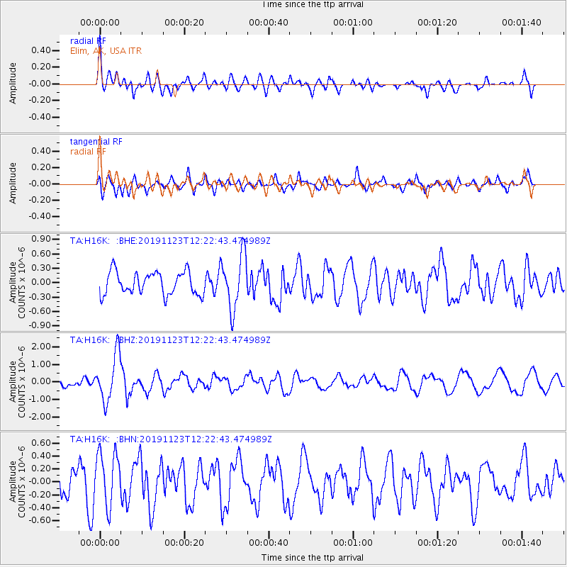
H16K Elim, AK, USA - Earthquake Result Viewer
*The percent match for this event was below the threshold and hence no stack was calculated.
| Earthquake location: |
Irian Jaya Region, Indonesia |
| Earthquake latitude/longitude: |
1.6/132.8 |
| Earthquake time(UTC): |
2019/11/23 (327) 12:11:16 GMT |
| Earthquake Depth: |
10 km |
| Earthquake Magnitude: |
6.1 Mww |
| Earthquake Catalog/Contributor: |
NEIC PDE/us |
|
| Network: |
TA USArray Transportable Network (new EarthScope stations) |
| Station: |
H16K Elim, AK, USA |
| Lat/Lon: |
64.64 N/162.24 W |
| Elevation: |
216 m |
|
| Distance: |
78.0 deg |
| Az: |
23.513 deg |
| Baz: |
247.81 deg |
| Ray Param: |
$rayparam |
*The percent match for this event was below the threshold and hence was not used in the summary stack. |
|
| Radial Match: |
70.99727 % |
| Radial Bump: |
400 |
| Transverse Match: |
70.926796 % |
| Transverse Bump: |
400 |
| SOD ConfigId: |
19951751 |
| Insert Time: |
2019-12-07 12:21:09.164 +0000 |
| GWidth: |
2.5 |
| Max Bumps: |
400 |
| Tol: |
0.001 |
|
Signal To Noise
| Channel | StoN | STA | LTA |
| TA:H16K: :BHZ:20191123T12:22:43.474989Z | 6.5991626 | 1.3693393E-6 | 2.0750198E-7 |
| TA:H16K: :BHN:20191123T12:22:43.474989Z | 1.7340225 | 4.2184502E-7 | 2.432754E-7 |
| TA:H16K: :BHE:20191123T12:22:43.474989Z | 2.410209 | 5.692817E-7 | 2.3619602E-7 |
| Arrivals |
| Ps | |
| PpPs | |
| PsPs/PpSs | |


