F27A Lemmon, SD, USA - Earthquake Result Viewer
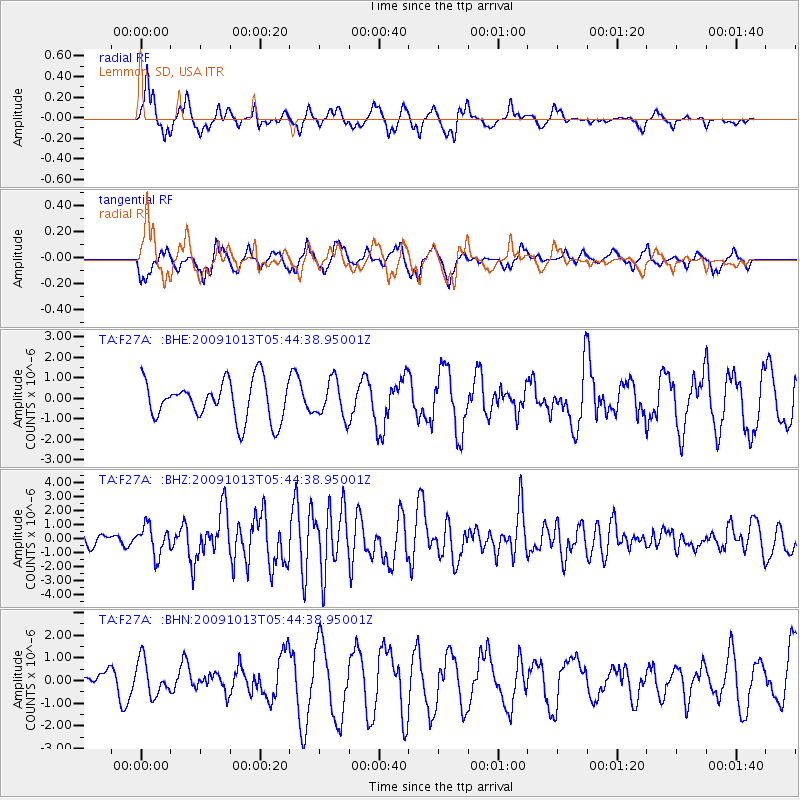
Earthquake location: Fox Islands, Aleutian Islands
Earthquake latitude/longitude: 52.8/-167.0
Earthquake time(UTC): 2009/10/13 (286) 05:37:23 GMT
Earthquake Depth: 24 km
Earthquake Magnitude: 6.0 MB, 6.1 MS, 6.5 MW, 6.5 MW
Earthquake Catalog/Contributor: WHDF/NEIC
Network: TA USArray Transportable Network (new EarthScope stations)
Station: F27A Lemmon, SD, USA
Lat/Lon: 45.87 N/102.02 W
Elevation: 757 m
Distance: 41.6 deg
Az: 72.452 deg
Baz: 303.954 deg
Ray Param: 0.073648065
Estimated Moho Depth: 20.5 km
Estimated Crust Vp/Vs: 1.60
Assumed Crust Vp: 6.242 km/s
Estimated Crust Vs: 3.901 km/s
Estimated Crust Poisson's Ratio: 0.18
Radial Match: 81.553825 %
Radial Bump: 319
Transverse Match: 38.791306 %
Transverse Bump: 330
SOD ConfigId: 2622
Insert Time: 2010-03-07 06:10:35.197 +0000
GWidth: 2.5
Max Bumps: 400
Tol: 0.001

Signal To Noise

ChannelStoNSTALTA
TA:F27A: :BHZ:20091013T05:44:38.95001Z2.20822121.0288502E-64.6591808E-7
TA:F27A: :BHN:20091013T05:44:38.95001Z0.93974687.7512084E-78.248188E-7
TA:F27A: :BHE:20091013T05:44:38.95001Z0.938040739.0049866E-79.599783E-7
Arrivals
Ps2.1 SECOND
PpPs7.9 SECOND
PsPs/PpSs10 SECOND