You are here: Home > Network List > TA - USArray Transportable Network (new EarthScope stations) Stations List
> Station F27A Lemmon, SD, USA > Earthquake Result Viewer
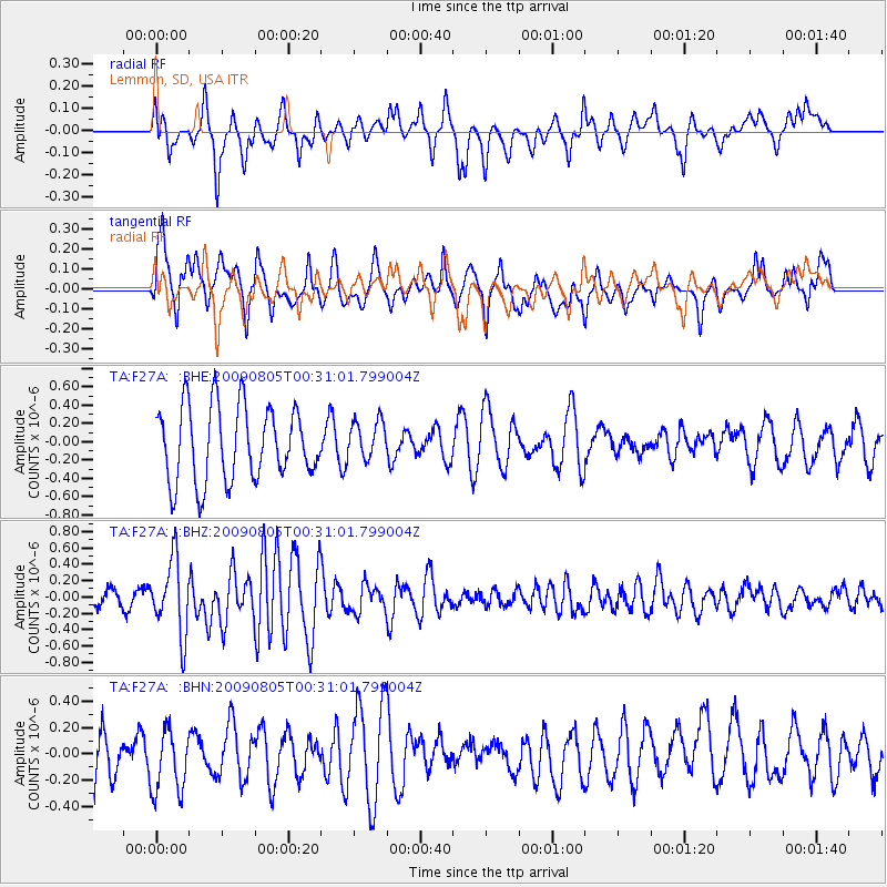
F27A Lemmon, SD, USA - Earthquake Result Viewer
*The percent match for this event was below the threshold and hence no stack was calculated.
| Earthquake location: |
Southwestern Ryukyu Isl., Japan |
| Earthquake latitude/longitude: |
24.2/125.1 |
| Earthquake time(UTC): |
2009/08/05 (217) 00:17:58 GMT |
| Earthquake Depth: |
25 km |
| Earthquake Magnitude: |
5.9 MB, 5.9 MS, 6.2 MW, 6.1 MW |
| Earthquake Catalog/Contributor: |
WHDF/NEIC |
|
| Network: |
TA USArray Transportable Network (new EarthScope stations) |
| Station: |
F27A Lemmon, SD, USA |
| Lat/Lon: |
45.87 N/102.02 W |
| Elevation: |
757 m |
|
| Distance: |
98.2 deg |
| Az: |
31.143 deg |
| Baz: |
317.487 deg |
| Ray Param: |
$rayparam |
*The percent match for this event was below the threshold and hence was not used in the summary stack. |
|
| Radial Match: |
39.409275 % |
| Radial Bump: |
369 |
| Transverse Match: |
51.54906 % |
| Transverse Bump: |
400 |
| SOD ConfigId: |
2622 |
| Insert Time: |
2010-03-07 06:10:40.017 +0000 |
| GWidth: |
2.5 |
| Max Bumps: |
400 |
| Tol: |
0.001 |
|
Signal To Noise
| Channel | StoN | STA | LTA |
| TA:F27A: :BHZ:20090805T00:31:01.799004Z | 3.5747185 | 4.535907E-7 | 1.2688851E-7 |
| TA:F27A: :BHN:20090805T00:31:01.799004Z | 1.4669995 | 2.4289642E-7 | 1.6557361E-7 |
| TA:F27A: :BHE:20090805T00:31:01.799004Z | 0.52270925 | 2.1272155E-7 | 4.0695957E-7 |
| Arrivals |
| Ps | |
| PpPs | |
| PsPs/PpSs | |


