You are here: Home > Network List > TA - USArray Transportable Network (new EarthScope stations) Stations List
> Station F27A Lemmon, SD, USA > Earthquake Result Viewer
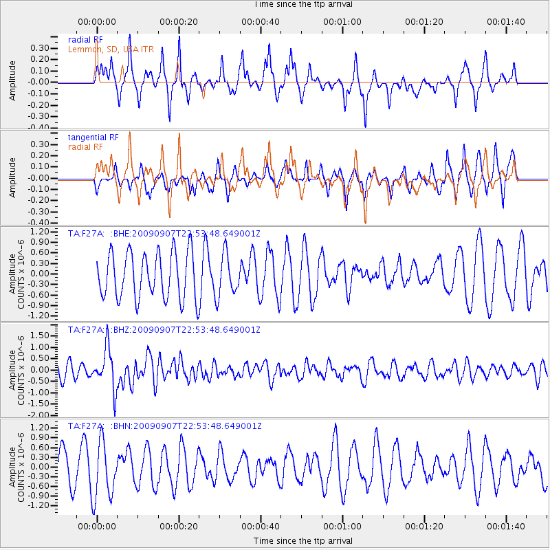
F27A Lemmon, SD, USA - Earthquake Result Viewer
*The percent match for this event was below the threshold and hence no stack was calculated.
| Earthquake location: |
Northwestern Caucasus |
| Earthquake latitude/longitude: |
42.7/43.4 |
| Earthquake time(UTC): |
2009/09/07 (250) 22:41:37 GMT |
| Earthquake Depth: |
15 km |
| Earthquake Magnitude: |
5.7 MB, 5.8 MS, 6.0 MW, 5.9 MW |
| Earthquake Catalog/Contributor: |
WHDF/NEIC |
|
| Network: |
TA USArray Transportable Network (new EarthScope stations) |
| Station: |
F27A Lemmon, SD, USA |
| Lat/Lon: |
45.87 N/102.02 W |
| Elevation: |
757 m |
|
| Distance: |
86.6 deg |
| Az: |
336.623 deg |
| Baz: |
24.766 deg |
| Ray Param: |
$rayparam |
*The percent match for this event was below the threshold and hence was not used in the summary stack. |
|
| Radial Match: |
46.325752 % |
| Radial Bump: |
262 |
| Transverse Match: |
46.118397 % |
| Transverse Bump: |
314 |
| SOD ConfigId: |
2622 |
| Insert Time: |
2010-03-07 06:10:44.852 +0000 |
| GWidth: |
2.5 |
| Max Bumps: |
400 |
| Tol: |
0.001 |
|
Signal To Noise
| Channel | StoN | STA | LTA |
| TA:F27A: :BHZ:20090907T22:53:48.649001Z | 2.9087827 | 9.3827015E-7 | 3.2256455E-7 |
| TA:F27A: :BHN:20090907T22:53:48.649001Z | 1.7429526 | 8.6236787E-7 | 4.9477416E-7 |
| TA:F27A: :BHE:20090907T22:53:48.649001Z | 0.9150389 | 6.0021705E-7 | 6.559471E-7 |
| Arrivals |
| Ps | |
| PpPs | |
| PsPs/PpSs | |


