You are here: Home > Network List > TA - USArray Transportable Network (new EarthScope stations) Stations List
> Station F27A Lemmon, SD, USA > Earthquake Result Viewer
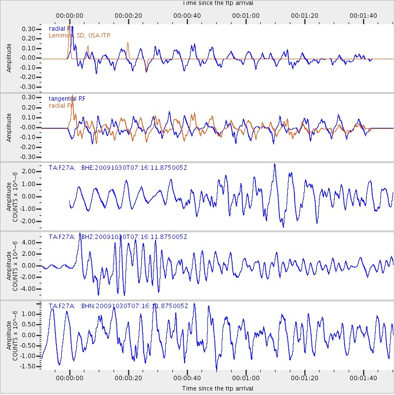
F27A Lemmon, SD, USA - Earthquake Result Viewer
*The percent match for this event was below the threshold and hence no stack was calculated.
| Earthquake location: |
Ryukyu Islands, Japan |
| Earthquake latitude/longitude: |
29.2/129.8 |
| Earthquake time(UTC): |
2009/10/30 (303) 07:03:39 GMT |
| Earthquake Depth: |
34 km |
| Earthquake Magnitude: |
6.3 MB, 6.8 MS, 6.8 MW, 6.8 MW |
| Earthquake Catalog/Contributor: |
WHDF/NEIC |
|
| Network: |
TA USArray Transportable Network (new EarthScope stations) |
| Station: |
F27A Lemmon, SD, USA |
| Lat/Lon: |
45.87 N/102.02 W |
| Elevation: |
757 m |
|
| Distance: |
91.7 deg |
| Az: |
33.32 deg |
| Baz: |
316.583 deg |
| Ray Param: |
$rayparam |
*The percent match for this event was below the threshold and hence was not used in the summary stack. |
|
| Radial Match: |
66.17054 % |
| Radial Bump: |
274 |
| Transverse Match: |
70.40357 % |
| Transverse Bump: |
372 |
| SOD ConfigId: |
2622 |
| Insert Time: |
2010-03-07 06:10:50.326 +0000 |
| GWidth: |
2.5 |
| Max Bumps: |
400 |
| Tol: |
0.001 |
|
Signal To Noise
| Channel | StoN | STA | LTA |
| TA:F27A: :BHZ:20091030T07:16:11.875005Z | 8.420714 | 2.2930335E-6 | 2.7230865E-7 |
| TA:F27A: :BHN:20091030T07:16:11.875005Z | 1.3798556 | 7.4171635E-7 | 5.3753183E-7 |
| TA:F27A: :BHE:20091030T07:16:11.875005Z | 1.0938448 | 6.842896E-7 | 6.25582E-7 |
| Arrivals |
| Ps | |
| PpPs | |
| PsPs/PpSs | |


