You are here: Home > Network List > TA - USArray Transportable Network (new EarthScope stations) Stations List
> Station I30M Mount Dempster, Yukon, CAN > Earthquake Result Viewer
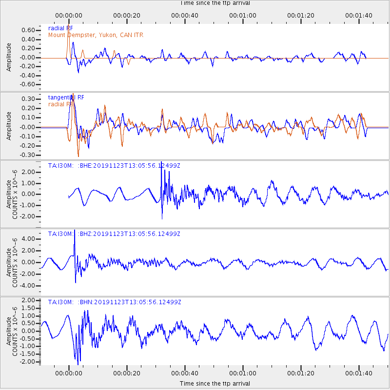
I30M Mount Dempster, Yukon, CAN - Earthquake Result Viewer
*The percent match for this event was below the threshold and hence no stack was calculated.
| Earthquake location: |
Kuril Islands |
| Earthquake latitude/longitude: |
43.9/147.2 |
| Earthquake time(UTC): |
2019/11/23 (327) 12:58:05 GMT |
| Earthquake Depth: |
6.3 km |
| Earthquake Magnitude: |
5.7 mb |
| Earthquake Catalog/Contributor: |
NEIC PDE/us |
|
| Network: |
TA USArray Transportable Network (new EarthScope stations) |
| Station: |
I30M Mount Dempster, Yukon, CAN |
| Lat/Lon: |
65.22 N/136.38 W |
| Elevation: |
1399 m |
|
| Distance: |
45.7 deg |
| Az: |
34.884 deg |
| Baz: |
281.025 deg |
| Ray Param: |
$rayparam |
*The percent match for this event was below the threshold and hence was not used in the summary stack. |
|
| Radial Match: |
61.90058 % |
| Radial Bump: |
400 |
| Transverse Match: |
82.81659 % |
| Transverse Bump: |
400 |
| SOD ConfigId: |
19951751 |
| Insert Time: |
2019-12-07 13:13:40.530 +0000 |
| GWidth: |
2.5 |
| Max Bumps: |
400 |
| Tol: |
0.001 |
|
Signal To Noise
| Channel | StoN | STA | LTA |
| TA:I30M: :BHZ:20191123T13:05:56.12499Z | 3.1308155 | 1.5691368E-6 | 5.011911E-7 |
| TA:I30M: :BHN:20191123T13:05:56.12499Z | 2.3516486 | 1.03122E-6 | 4.385094E-7 |
| TA:I30M: :BHE:20191123T13:05:56.12499Z | 2.4129384 | 9.481611E-7 | 3.9294872E-7 |
| Arrivals |
| Ps | |
| PpPs | |
| PsPs/PpSs | |


