You are here: Home > Network List > CI - Caltech Regional Seismic Network Stations List
> Station MPM Manuel Prospect Mine, California, USA > Earthquake Result Viewer
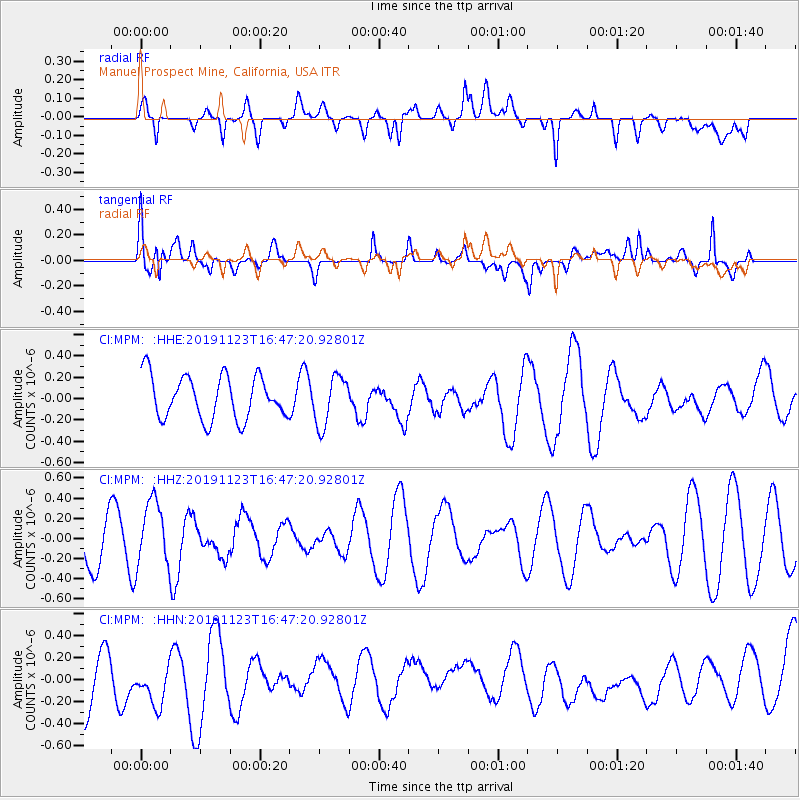
MPM Manuel Prospect Mine, California, USA - Earthquake Result Viewer
*The percent match for this event was below the threshold and hence no stack was calculated.
| Earthquake location: |
Off E. Coast Of N. Island, N.Z. |
| Earthquake latitude/longitude: |
-37.5/177.2 |
| Earthquake time(UTC): |
2019/11/23 (327) 16:34:44 GMT |
| Earthquake Depth: |
127 km |
| Earthquake Magnitude: |
5.8 Mww |
| Earthquake Catalog/Contributor: |
NEIC PDE/us |
|
| Network: |
CI Caltech Regional Seismic Network |
| Station: |
MPM Manuel Prospect Mine, California, USA |
| Lat/Lon: |
36.06 N/117.49 W |
| Elevation: |
185 m |
|
| Distance: |
95.0 deg |
| Az: |
47.639 deg |
| Baz: |
226.46 deg |
| Ray Param: |
$rayparam |
*The percent match for this event was below the threshold and hence was not used in the summary stack. |
|
| Radial Match: |
35.838547 % |
| Radial Bump: |
400 |
| Transverse Match: |
61.416737 % |
| Transverse Bump: |
400 |
| SOD ConfigId: |
19951751 |
| Insert Time: |
2019-12-07 16:41:17.373 +0000 |
| GWidth: |
2.5 |
| Max Bumps: |
400 |
| Tol: |
0.001 |
|
Signal To Noise
| Channel | StoN | STA | LTA |
| CI:MPM: :HHZ:20191123T16:47:20.92801Z | 1.3317026 | 3.230439E-7 | 2.425796E-7 |
| CI:MPM: :HHN:20191123T16:47:20.92801Z | 1.0491923 | 2.1489987E-7 | 2.048241E-7 |
| CI:MPM: :HHE:20191123T16:47:20.92801Z | 1.1614765 | 2.3391138E-7 | 2.0139142E-7 |
| Arrivals |
| Ps | |
| PpPs | |
| PsPs/PpSs | |


