You are here: Home > Network List > US - United States National Seismic Network Stations List
> Station MNTX Cornudas Mountains, Texas, USA > Earthquake Result Viewer
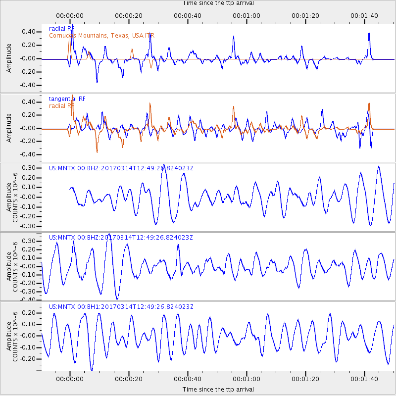
MNTX Cornudas Mountains, Texas, USA - Earthquake Result Viewer
*The percent match for this event was below the threshold and hence no stack was calculated.
| Earthquake location: |
Vanuatu Islands |
| Earthquake latitude/longitude: |
-21.0/170.0 |
| Earthquake time(UTC): |
2017/03/14 (073) 12:36:43 GMT |
| Earthquake Depth: |
130 km |
| Earthquake Magnitude: |
5.6 Mww |
| Earthquake Catalog/Contributor: |
NEIC PDE/us |
|
| Network: |
US United States National Seismic Network |
| Station: |
MNTX Cornudas Mountains, Texas, USA |
| Lat/Lon: |
31.70 N/105.38 W |
| Elevation: |
404 m |
|
| Distance: |
96.4 deg |
| Az: |
58.647 deg |
| Baz: |
249.425 deg |
| Ray Param: |
$rayparam |
*The percent match for this event was below the threshold and hence was not used in the summary stack. |
|
| Radial Match: |
78.36583 % |
| Radial Bump: |
364 |
| Transverse Match: |
58.08577 % |
| Transverse Bump: |
400 |
| SOD ConfigId: |
1992691 |
| Insert Time: |
2017-03-28 12:39:15.509 +0000 |
| GWidth: |
2.5 |
| Max Bumps: |
400 |
| Tol: |
0.001 |
|
Signal To Noise
| Channel | StoN | STA | LTA |
| US:MNTX:00:BHZ:20170314T12:49:26.824023Z | 0.8965952 | 1.3471654E-7 | 1.5025348E-7 |
| US:MNTX:00:BH1:20170314T12:49:26.824023Z | 0.9819941 | 1.3646488E-7 | 1.3896711E-7 |
| US:MNTX:00:BH2:20170314T12:49:26.824023Z | 2.9024012 | 2.1896345E-7 | 7.544217E-8 |
| Arrivals |
| Ps | |
| PpPs | |
| PsPs/PpSs | |


