
PAS Pasadena, California, USA - Earthquake Result Viewer
| ||||||||||||||||||
| ||||||||||||||||||
| ||||||||||||||||||
|
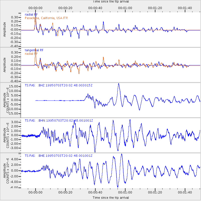
Signal To Noise
| Channel | StoN | STA | LTA |
| TS:PAS: :BHN:19950703T20:02:48.001001Z | 4.5711656 | 4.906503E-7 | 1.0733592E-7 |
| TS:PAS: :BHE:19950703T20:02:48.001001Z | 3.992749 | 4.597671E-7 | 1.1515051E-7 |
| TS:PAS: :BHZ:19950703T20:02:48.003015Z | 25.493559 | 2.0801638E-6 | 8.1595665E-8 |
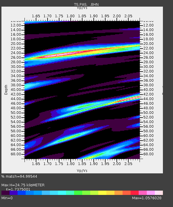
| Arrivals | |
| Ps | 3.1 SECOND |
| PpPs | 11 SECOND |
| PsPs/PpSs | 14 SECOND |

