You are here: Home > Network List > PF - Volcanologic Network of Piton de Fournaise-OVPF Stations List
> Station HIM cratere Himiltrude > Earthquake Result Viewer
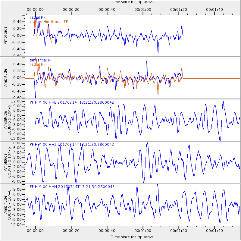
HIM cratere Himiltrude - Earthquake Result Viewer
*The percent match for this event was below the threshold and hence no stack was calculated.
| Earthquake location: |
Off W Coast Of Northern Sumatra |
| Earthquake latitude/longitude: |
3.6/95.9 |
| Earthquake time(UTC): |
2017/03/14 (073) 13:13:38 GMT |
| Earthquake Depth: |
41 km |
| Earthquake Magnitude: |
5.5 mb |
| Earthquake Catalog/Contributor: |
NEIC PDE/us |
|
| Network: |
PF Volcanologic Network of Piton de Fournaise-OVPF |
| Station: |
HIM cratere Himiltrude |
| Lat/Lon: |
21.21 S/55.72 E |
| Elevation: |
1958 m |
|
| Distance: |
46.4 deg |
| Az: |
236.111 deg |
| Baz: |
62.609 deg |
| Ray Param: |
$rayparam |
*The percent match for this event was below the threshold and hence was not used in the summary stack. |
|
| Radial Match: |
67.4977 % |
| Radial Bump: |
400 |
| Transverse Match: |
56.79378 % |
| Transverse Bump: |
400 |
| SOD ConfigId: |
1992691 |
| Insert Time: |
2017-03-28 13:17:25.767 +0000 |
| GWidth: |
2.5 |
| Max Bumps: |
400 |
| Tol: |
0.001 |
|
Signal To Noise
| Channel | StoN | STA | LTA |
| PF:HIM:00:HHZ:20170314T13:21:30.280004Z | 1.8964252 | 5.1405164E-6 | 2.710635E-6 |
| PF:HIM:00:HHN:20170314T13:21:30.280004Z | 1.4765605 | 4.747041E-6 | 3.214932E-6 |
| PF:HIM:00:HHE:20170314T13:21:30.280004Z | 0.83332884 | 2.9687492E-6 | 3.5625185E-6 |
| Arrivals |
| Ps | |
| PpPs | |
| PsPs/PpSs | |


