You are here: Home > Network List > GS - US Geological Survey Networks Stations List
> Station KAN09 East Station, Caldwell, KS, USA > Earthquake Result Viewer
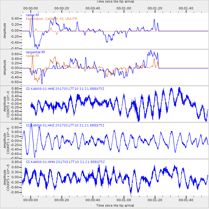
KAN09 East Station, Caldwell, KS, USA - Earthquake Result Viewer
*The percent match for this event was below the threshold and hence no stack was calculated.
| Earthquake location: |
South Of Fiji Islands |
| Earthquake latitude/longitude: |
-23.6/-176.8 |
| Earthquake time(UTC): |
2017/03/17 (076) 10:18:39 GMT |
| Earthquake Depth: |
109 km |
| Earthquake Magnitude: |
5.5 mb |
| Earthquake Catalog/Contributor: |
NEIC PDE/us |
|
| Network: |
GS US Geological Survey Networks |
| Station: |
KAN09 East Station, Caldwell, KS, USA |
| Lat/Lon: |
37.14 N/97.62 W |
| Elevation: |
371 m |
|
| Distance: |
95.8 deg |
| Az: |
52.086 deg |
| Baz: |
244.9 deg |
| Ray Param: |
$rayparam |
*The percent match for this event was below the threshold and hence was not used in the summary stack. |
|
| Radial Match: |
56.972744 % |
| Radial Bump: |
400 |
| Transverse Match: |
53.248707 % |
| Transverse Bump: |
400 |
| SOD ConfigId: |
1992691 |
| Insert Time: |
2017-03-31 10:19:49.494 +0000 |
| GWidth: |
2.5 |
| Max Bumps: |
400 |
| Tol: |
0.001 |
|
Signal To Noise
| Channel | StoN | STA | LTA |
| GS:KAN09:01:HHZ:20170317T10:31:21.888975Z | 1.8003343 | 4.663741E-7 | 2.590486E-7 |
| GS:KAN09:01:HHN:20170317T10:31:21.888975Z | 0.7348523 | 2.8857852E-7 | 3.9270273E-7 |
| GS:KAN09:01:HHE:20170317T10:31:21.888975Z | 2.055308 | 3.4233474E-7 | 1.6656128E-7 |
| Arrivals |
| Ps | |
| PpPs | |
| PsPs/PpSs | |


