You are here: Home > Network List > US - United States National Seismic Network Stations List
> Station HAWA Hanford, Washington, USA > Earthquake Result Viewer
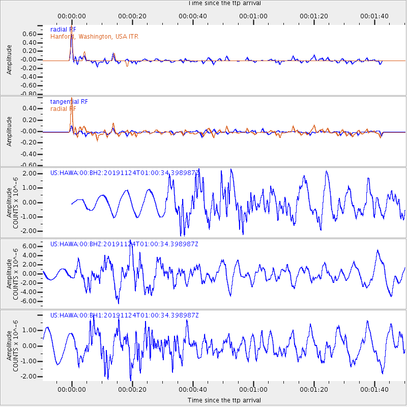
HAWA Hanford, Washington, USA - Earthquake Result Viewer
*The percent match for this event was below the threshold and hence no stack was calculated.
| Earthquake location: |
Andreanof Islands, Aleutian Is. |
| Earthquake latitude/longitude: |
51.2/-175.6 |
| Earthquake time(UTC): |
2019/11/24 (328) 00:54:03 GMT |
| Earthquake Depth: |
34 km |
| Earthquake Magnitude: |
5.6 Mi |
| Earthquake Catalog/Contributor: |
NEIC PDE/at |
|
| Network: |
US United States National Seismic Network |
| Station: |
HAWA Hanford, Washington, USA |
| Lat/Lon: |
46.39 N/119.53 W |
| Elevation: |
364 m |
|
| Distance: |
36.5 deg |
| Az: |
75.008 deg |
| Baz: |
298.572 deg |
| Ray Param: |
$rayparam |
*The percent match for this event was below the threshold and hence was not used in the summary stack. |
|
| Radial Match: |
74.46037 % |
| Radial Bump: |
384 |
| Transverse Match: |
74.877945 % |
| Transverse Bump: |
400 |
| SOD ConfigId: |
19951751 |
| Insert Time: |
2019-12-08 01:11:39.304 +0000 |
| GWidth: |
2.5 |
| Max Bumps: |
400 |
| Tol: |
0.001 |
|
Signal To Noise
| Channel | StoN | STA | LTA |
| US:HAWA:00:BHZ:20191124T01:00:34.398987Z | 2.212783 | 1.7332279E-6 | 7.832796E-7 |
| US:HAWA:00:BH1:20191124T01:00:34.398987Z | 1.0883484 | 7.094936E-7 | 6.518993E-7 |
| US:HAWA:00:BH2:20191124T01:00:34.398987Z | 1.9894809 | 1.0147598E-6 | 5.1006265E-7 |
| Arrivals |
| Ps | |
| PpPs | |
| PsPs/PpSs | |


