You are here: Home > Network List > IU - Global Seismograph Network (GSN - IRIS/USGS) Stations List
> Station FURI Mt. Furi, Ethiopia > Earthquake Result Viewer
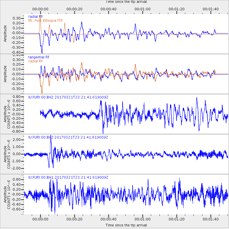
FURI Mt. Furi, Ethiopia - Earthquake Result Viewer
*The percent match for this event was below the threshold and hence no stack was calculated.
| Earthquake location: |
Bali Region, Indonesia |
| Earthquake latitude/longitude: |
-8.6/115.3 |
| Earthquake time(UTC): |
2017/03/21 (080) 23:10:25 GMT |
| Earthquake Depth: |
118 km |
| Earthquake Magnitude: |
5.5 Mww |
| Earthquake Catalog/Contributor: |
NEIC PDE/us |
|
| Network: |
IU Global Seismograph Network (GSN - IRIS/USGS) |
| Station: |
FURI Mt. Furi, Ethiopia |
| Lat/Lon: |
8.90 N/38.68 E |
| Elevation: |
2570 m |
|
| Distance: |
78.3 deg |
| Az: |
280.946 deg |
| Baz: |
100.722 deg |
| Ray Param: |
$rayparam |
*The percent match for this event was below the threshold and hence was not used in the summary stack. |
|
| Radial Match: |
75.07446 % |
| Radial Bump: |
400 |
| Transverse Match: |
73.20682 % |
| Transverse Bump: |
400 |
| SOD ConfigId: |
1992691 |
| Insert Time: |
2017-04-04 23:11:41.925 +0000 |
| GWidth: |
2.5 |
| Max Bumps: |
400 |
| Tol: |
0.001 |
|
Signal To Noise
| Channel | StoN | STA | LTA |
| IU:FURI:00:BHZ:20170321T23:21:41.619009Z | 2.8391662 | 3.360835E-7 | 1.1837402E-7 |
| IU:FURI:00:BH1:20170321T23:21:41.619009Z | 1.0266422 | 1.1626133E-7 | 1.13244255E-7 |
| IU:FURI:00:BH2:20170321T23:21:41.619009Z | 1.20557 | 1.0600884E-7 | 8.7932555E-8 |
| Arrivals |
| Ps | |
| PpPs | |
| PsPs/PpSs | |


