You are here: Home > Network List > TA - USArray Transportable Network (new EarthScope stations) Stations List
> Station D26A Manning, ND, USA > Earthquake Result Viewer
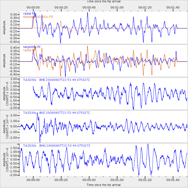
D26A Manning, ND, USA - Earthquake Result Viewer
*The percent match for this event was below the threshold and hence no stack was calculated.
| Earthquake location: |
Northwestern Caucasus |
| Earthquake latitude/longitude: |
42.7/43.4 |
| Earthquake time(UTC): |
2009/09/07 (250) 22:41:37 GMT |
| Earthquake Depth: |
15 km |
| Earthquake Magnitude: |
5.7 MB, 5.8 MS, 6.0 MW, 5.9 MW |
| Earthquake Catalog/Contributor: |
WHDF/NEIC |
|
| Network: |
TA USArray Transportable Network (new EarthScope stations) |
| Station: |
D26A Manning, ND, USA |
| Lat/Lon: |
47.03 N/102.44 W |
| Elevation: |
693 m |
|
| Distance: |
85.7 deg |
| Az: |
337.369 deg |
| Baz: |
24.516 deg |
| Ray Param: |
$rayparam |
*The percent match for this event was below the threshold and hence was not used in the summary stack. |
|
| Radial Match: |
69.3679 % |
| Radial Bump: |
400 |
| Transverse Match: |
70.48342 % |
| Transverse Bump: |
400 |
| SOD ConfigId: |
2622 |
| Insert Time: |
2010-03-07 06:14:32.749 +0000 |
| GWidth: |
2.5 |
| Max Bumps: |
400 |
| Tol: |
0.001 |
|
Signal To Noise
| Channel | StoN | STA | LTA |
| TA:D26A: :BHZ:20090907T22:53:44.075027Z | 3.2982645 | 1.2196497E-6 | 3.6978528E-7 |
| TA:D26A: :BHN:20090907T22:53:44.075027Z | 0.8566785 | 7.3124806E-7 | 8.5358516E-7 |
| TA:D26A: :BHE:20090907T22:53:44.075027Z | 0.6998668 | 4.0890947E-7 | 5.8426764E-7 |
| Arrivals |
| Ps | |
| PpPs | |
| PsPs/PpSs | |


