You are here: Home > Network List > TS - TERRAscope (Southern California Seismic Network) Stations List
> Station PAS Pasadena, California, USA > Earthquake Result Viewer
PAS Pasadena, California, USA - Earthquake Result Viewer

| Earthquake location: |
Near Coast Of Nicaragua |
| Earthquake latitude/longitude: |
11.1/-86.1 |
| Earthquake time(UTC): |
1996/11/17 (322) 19:17:41 GMT |
| Earthquake Depth: |
33 km |
| Earthquake Magnitude: |
5.5 MB, 5.6 MS, 5.9 UNKNOWN, 5.9 MW |
| Earthquake Catalog/Contributor: |
WHDF/NEIC |
|
| Network: |
TS TERRAscope (Southern California Seismic Network) |
| Station: |
PAS Pasadena, California, USA |
| Lat/Lon: |
34.15 N/118.17 W |
| Elevation: |
295 m |
|
| Distance: |
37.2 deg |
| Az: |
313.219 deg |
| Baz: |
120.396 deg |
| Ray Param: |
0.07618591 |
| Estimated Moho Depth: |
25.5 km |
| Estimated Crust Vp/Vs: |
1.84 |
| Assumed Crust Vp: |
6.1 km/s |
| Estimated Crust Vs: |
3.311 km/s |
| Estimated Crust Poisson's Ratio: |
0.29 |
|
| Radial Match: |
87.37774 % |
| Radial Bump: |
400 |
| Transverse Match: |
67.25386 % |
| Transverse Bump: |
400 |
| SOD ConfigId: |
9875 |
| Insert Time: |
2010-02-26 14:36:29.038 +0000 |
| GWidth: |
2.5 |
| Max Bumps: |
400 |
| Tol: |
0.001 |
|
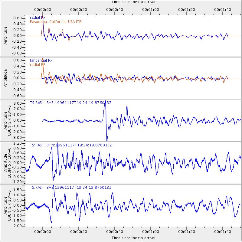
Signal To Noise
| Channel | StoN | STA | LTA |
| TS:PAS: :BHN:19961117T19:24:19.876013Z | 1.3896575 | 3.52664E-7 | 2.5377764E-7 |
| TS:PAS: :BHE:19961117T19:24:19.876013Z | 3.025088 | 5.597509E-7 | 1.8503623E-7 |
| TS:PAS: :BHZ:19961117T19:24:19.876013Z | 10.394955 | 1.2637385E-6 | 1.2157228E-7 |
| Arrivals |
| Ps | 3.8 SECOND |
| PpPs | 11 SECOND |
| PsPs/PpSs | 15 SECOND |


