You are here: Home > Network List > TA - USArray Transportable Network (new EarthScope stations) Stations List
> Station D26A Manning, ND, USA > Earthquake Result Viewer
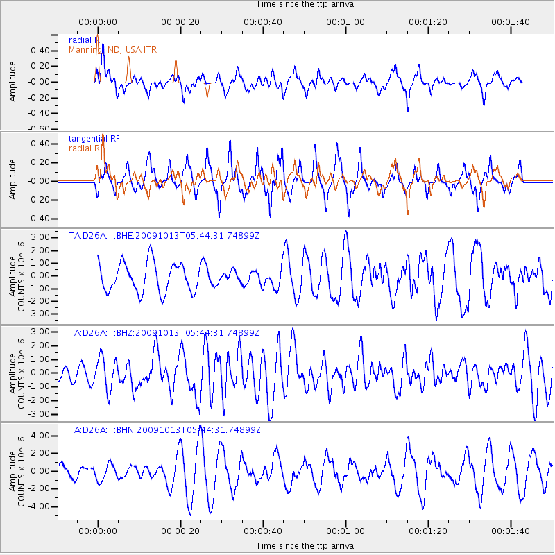
D26A Manning, ND, USA - Earthquake Result Viewer
*The percent match for this event was below the threshold and hence no stack was calculated.
| Earthquake location: |
Fox Islands, Aleutian Islands |
| Earthquake latitude/longitude: |
52.8/-167.0 |
| Earthquake time(UTC): |
2009/10/13 (286) 05:37:23 GMT |
| Earthquake Depth: |
24 km |
| Earthquake Magnitude: |
6.0 MB, 6.1 MS, 6.5 MW, 6.5 MW |
| Earthquake Catalog/Contributor: |
WHDF/NEIC |
|
| Network: |
TA USArray Transportable Network (new EarthScope stations) |
| Station: |
D26A Manning, ND, USA |
| Lat/Lon: |
47.03 N/102.44 W |
| Elevation: |
693 m |
|
| Distance: |
40.7 deg |
| Az: |
71.222 deg |
| Baz: |
302.728 deg |
| Ray Param: |
$rayparam |
*The percent match for this event was below the threshold and hence was not used in the summary stack. |
|
| Radial Match: |
65.95657 % |
| Radial Bump: |
400 |
| Transverse Match: |
63.264847 % |
| Transverse Bump: |
368 |
| SOD ConfigId: |
2622 |
| Insert Time: |
2010-03-07 06:14:39.980 +0000 |
| GWidth: |
2.5 |
| Max Bumps: |
400 |
| Tol: |
0.001 |
|
Signal To Noise
| Channel | StoN | STA | LTA |
| TA:D26A: :BHZ:20091013T05:44:31.74899Z | 3.1698027 | 1.1767868E-6 | 3.7124923E-7 |
| TA:D26A: :BHN:20091013T05:44:31.74899Z | 1.2671187 | 8.9668845E-7 | 7.0765935E-7 |
| TA:D26A: :BHE:20091013T05:44:31.74899Z | 0.357849 | 4.078298E-7 | 1.1396701E-6 |
| Arrivals |
| Ps | |
| PpPs | |
| PsPs/PpSs | |


