PAS Pasadena, California, USA - Earthquake Result Viewer
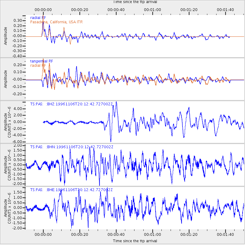
Earthquake location: Bonin Islands, Japan Region
Earthquake latitude/longitude: 28.0/143.5
Earthquake time(UTC): 1996/11/06 (311) 20:00:58 GMT
Earthquake Depth: 9.0 km
Earthquake Magnitude: 6.4 MB, 6.5 MS, 6.6 UNKNOWN, 6.4 ME
Earthquake Catalog/Contributor: WHDF/NEIC
Network: TS TERRAscope (Southern California Seismic Network)
Station: PAS Pasadena, California, USA
Lat/Lon: 34.15 N/118.17 W
Elevation: 295 m
Distance: 81.1 deg
Az: 56.174 deg
Baz: 297.656 deg
Ray Param: 0.047845904
Estimated Moho Depth: 19.25 km
Estimated Crust Vp/Vs: 2.10
Assumed Crust Vp: 6.1 km/s
Estimated Crust Vs: 2.908 km/s
Estimated Crust Poisson's Ratio: 0.35
Radial Match: 85.691574 %
Radial Bump: 400
Transverse Match: 85.803345 %
Transverse Bump: 400
SOD ConfigId: 6273
Insert Time: 2010-02-26 14:36:30.161 +0000
GWidth: 2.5
Max Bumps: 400
Tol: 0.001

Signal To Noise

ChannelStoNSTALTA
TS:PAS: :BHN:19961106T20:12:42.727002Z1.48868672.4515106E-71.6467605E-7
TS:PAS: :BHE:19961106T20:12:42.727002Z1.74874423.4889382E-71.9951106E-7
TS:PAS: :BHZ:19961106T20:12:42.727002Z3.060237.704559E-72.5176405E-7
Arrivals
Ps3.5 SECOND
PpPs9.6 SECOND
PsPs/PpSs13 SECOND