
PAS Pasadena, California, USA - Earthquake Result Viewer
| ||||||||||||||||||
| ||||||||||||||||||
| ||||||||||||||||||
|
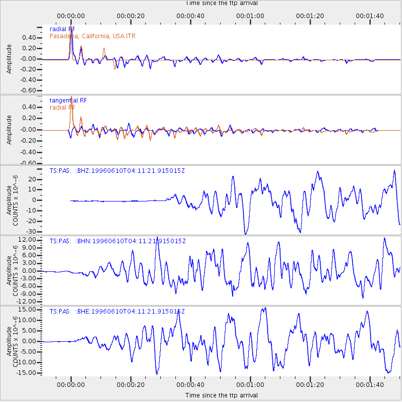
Signal To Noise
| Channel | StoN | STA | LTA |
| TS:PAS: :BHN:19960610T04:11:21.915015Z | 5.1508956 | 5.812522E-7 | 1.1284488E-7 |
| TS:PAS: :BHE:19960610T04:11:21.915015Z | 5.8443317 | 9.270145E-7 | 1.5861771E-7 |
| TS:PAS: :BHZ:19960610T04:11:21.915015Z | 14.067114 | 2.2952183E-6 | 1.6316199E-7 |
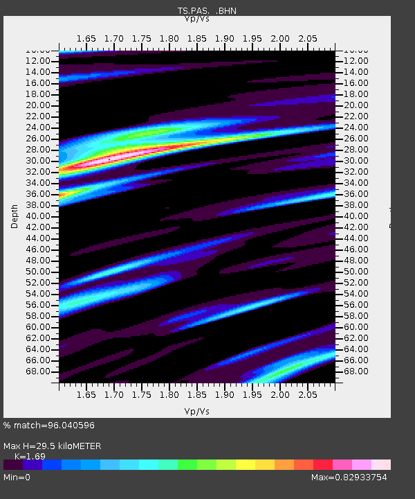
| Arrivals | |
| Ps | 3.5 SECOND |
| PpPs | 12 SECOND |
| PsPs/PpSs | 16 SECOND |

