
PAS Pasadena, California, USA - Earthquake Result Viewer
| ||||||||||||||||||
| ||||||||||||||||||
| ||||||||||||||||||
|
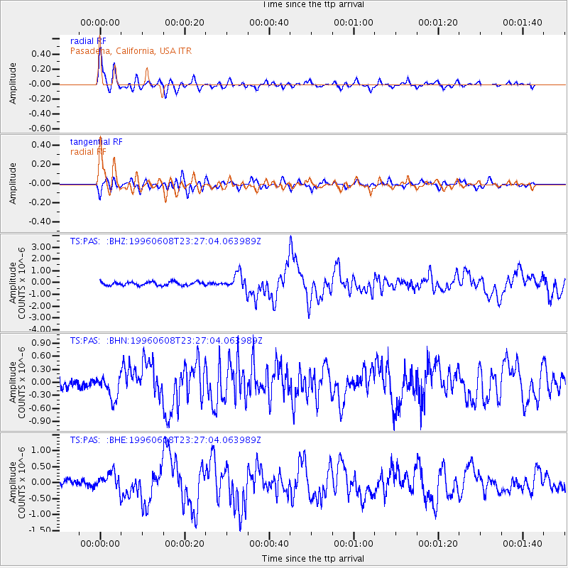
Signal To Noise
| Channel | StoN | STA | LTA |
| TS:PAS: :BHN:19960608T23:27:04.063989Z | 1.7450852 | 2.6265212E-7 | 1.5050962E-7 |
| TS:PAS: :BHE:19960608T23:27:04.063989Z | 2.0944238 | 2.771862E-7 | 1.3234485E-7 |
| TS:PAS: :BHZ:19960608T23:27:04.063989Z | 4.5524964 | 6.90233E-7 | 1.5161638E-7 |
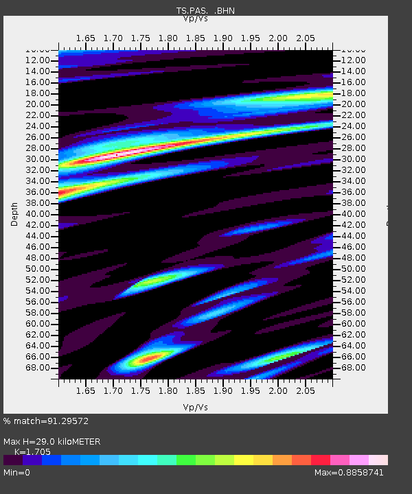
| Arrivals | |
| Ps | 3.6 SECOND |
| PpPs | 12 SECOND |
| PsPs/PpSs | 16 SECOND |

