You are here: Home > Network List > US - United States National Seismic Network Stations List
> Station MSO Missoula, Montana, USA > Earthquake Result Viewer
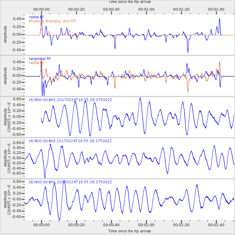
MSO Missoula, Montana, USA - Earthquake Result Viewer
*The percent match for this event was below the threshold and hence no stack was calculated.
| Earthquake location: |
Ryukyu Islands, Japan |
| Earthquake latitude/longitude: |
26.9/127.2 |
| Earthquake time(UTC): |
2017/03/24 (083) 16:43:27 GMT |
| Earthquake Depth: |
77 km |
| Earthquake Magnitude: |
5.1 Mww |
| Earthquake Catalog/Contributor: |
NEIC PDE/us |
|
| Network: |
US United States National Seismic Network |
| Station: |
MSO Missoula, Montana, USA |
| Lat/Lon: |
46.83 N/113.94 W |
| Elevation: |
1264 m |
|
| Distance: |
88.2 deg |
| Az: |
36.997 deg |
| Baz: |
308.491 deg |
| Ray Param: |
$rayparam |
*The percent match for this event was below the threshold and hence was not used in the summary stack. |
|
| Radial Match: |
39.317226 % |
| Radial Bump: |
303 |
| Transverse Match: |
59.10859 % |
| Transverse Bump: |
400 |
| SOD ConfigId: |
2028011 |
| Insert Time: |
2017-04-09 16:33:31.705 +0000 |
| GWidth: |
2.5 |
| Max Bumps: |
400 |
| Tol: |
0.001 |
|
Signal To Noise
| Channel | StoN | STA | LTA |
| US:MSO:00:BHZ:20170324T16:55:38.375002Z | 2.8972526 | 3.6861175E-7 | 1.2722803E-7 |
| US:MSO:00:BH1:20170324T16:55:38.375002Z | 2.3552687 | 2.5830334E-7 | 1.0967043E-7 |
| US:MSO:00:BH2:20170324T16:55:38.375002Z | 1.0783714 | 3.1391866E-7 | 2.9110439E-7 |
| Arrivals |
| Ps | |
| PpPs | |
| PsPs/PpSs | |


