PAS Pasadena, California, USA - Earthquake Result Viewer
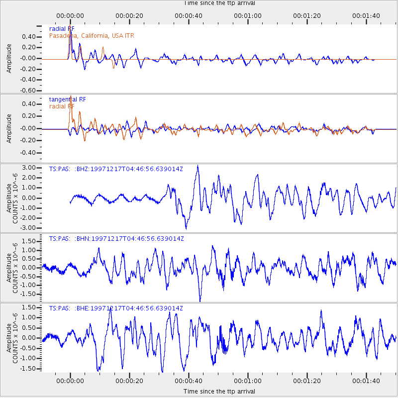
Earthquake location: Rat Islands, Aleutian Islands
Earthquake latitude/longitude: 51.2/178.9
Earthquake time(UTC): 1997/12/17 (351) 04:38:51 GMT
Earthquake Depth: 20 km
Earthquake Magnitude: 5.8 MB, 6.5 MS, 6.7 UNKNOWN, 6.1 ME
Earthquake Catalog/Contributor: WHDF/NEIC
Network: TS TERRAscope (Southern California Seismic Network)
Station: PAS Pasadena, California, USA
Lat/Lon: 34.15 N/118.17 W
Elevation: 295 m
Distance: 47.8 deg
Az: 85.463 deg
Baz: 310.846 deg
Ray Param: 0.069726236
Estimated Moho Depth: 50.5 km
Estimated Crust Vp/Vs: 1.83
Assumed Crust Vp: 6.1 km/s
Estimated Crust Vs: 3.338 km/s
Estimated Crust Poisson's Ratio: 0.29
Radial Match: 90.80634 %
Radial Bump: 400
Transverse Match: 62.31797 %
Transverse Bump: 400
SOD ConfigId: 9875
Insert Time: 2010-02-26 14:36:41.003 +0000
GWidth: 2.5
Max Bumps: 400
Tol: 0.001

Signal To Noise

ChannelStoNSTALTA
TS:PAS: :BHN:19971217T04:46:56.639014Z1.62980022.6010514E-71.5959327E-7
TS:PAS: :BHE:19971217T04:46:56.639014Z1.40177522.2347301E-71.5942143E-7
TS:PAS: :BHZ:19971217T04:46:56.639014Z2.54395586.316179E-72.482818E-7
Arrivals
Ps7.2 SECOND
PpPs22 SECOND
PsPs/PpSs29 SECOND