You are here: Home > Network List > G - GEOSCOPE Stations List
> Station CLF Chambon la Foret observatory, France > Earthquake Result Viewer
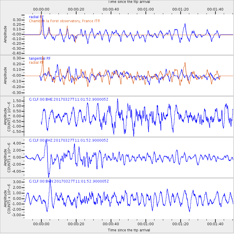
CLF Chambon la Foret observatory, France - Earthquake Result Viewer
*The percent match for this event was below the threshold and hence no stack was calculated.
| Earthquake location: |
Near Islands, Aleutian Islands |
| Earthquake latitude/longitude: |
52.8/172.2 |
| Earthquake time(UTC): |
2017/03/27 (086) 10:50:19 GMT |
| Earthquake Depth: |
10 km |
| Earthquake Magnitude: |
6.1 Mww |
| Earthquake Catalog/Contributor: |
NEIC PDE/us |
|
| Network: |
G GEOSCOPE |
| Station: |
CLF Chambon la Foret observatory, France |
| Lat/Lon: |
48.03 N/2.26 E |
| Elevation: |
145 m |
|
| Distance: |
79.2 deg |
| Az: |
353.143 deg |
| Baz: |
6.2 deg |
| Ray Param: |
$rayparam |
*The percent match for this event was below the threshold and hence was not used in the summary stack. |
|
| Radial Match: |
69.518394 % |
| Radial Bump: |
400 |
| Transverse Match: |
62.723274 % |
| Transverse Bump: |
400 |
| SOD ConfigId: |
2028011 |
| Insert Time: |
2017-04-10 10:55:36.457 +0000 |
| GWidth: |
2.5 |
| Max Bumps: |
400 |
| Tol: |
0.001 |
|
Signal To Noise
| Channel | StoN | STA | LTA |
| G:CLF:00:BHZ:20170327T11:01:52.900005Z | 7.3791924 | 2.863185E-6 | 3.8800792E-7 |
| G:CLF:00:BHN:20170327T11:01:52.900005Z | 2.9315925 | 1.1607498E-6 | 3.9594516E-7 |
| G:CLF:00:BHE:20170327T11:01:52.900005Z | 1.3017478 | 6.446618E-7 | 4.952279E-7 |
| Arrivals |
| Ps | |
| PpPs | |
| PsPs/PpSs | |


