You are here: Home > Network List > TA - USArray Transportable Network (new EarthScope stations) Stations List
> Station D23K Nanushuk River, AK USA > Earthquake Result Viewer
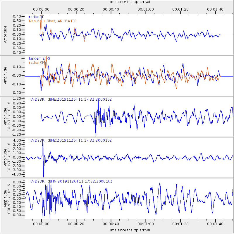
D23K Nanushuk River, AK USA - Earthquake Result Viewer
*The percent match for this event was below the threshold and hence no stack was calculated.
| Earthquake location: |
Myanmar |
| Earthquake latitude/longitude: |
19.2/94.9 |
| Earthquake time(UTC): |
2019/11/26 (330) 11:05:57 GMT |
| Earthquake Depth: |
60 km |
| Earthquake Magnitude: |
5.4 Mww |
| Earthquake Catalog/Contributor: |
NEIC PDE/us |
|
| Network: |
TA USArray Transportable Network (new EarthScope stations) |
| Station: |
D23K Nanushuk River, AK USA |
| Lat/Lon: |
68.97 N/150.68 W |
| Elevation: |
406 m |
|
| Distance: |
80.5 deg |
| Az: |
19.476 deg |
| Baz: |
299.246 deg |
| Ray Param: |
$rayparam |
*The percent match for this event was below the threshold and hence was not used in the summary stack. |
|
| Radial Match: |
65.48141 % |
| Radial Bump: |
400 |
| Transverse Match: |
38.877884 % |
| Transverse Bump: |
400 |
| SOD ConfigId: |
19951751 |
| Insert Time: |
2019-12-10 11:16:56.869 +0000 |
| GWidth: |
2.5 |
| Max Bumps: |
400 |
| Tol: |
0.001 |
|
Signal To Noise
| Channel | StoN | STA | LTA |
| TA:D23K: :BHZ:20191126T11:17:32.200016Z | 6.1982 | 1.5120951E-6 | 2.4395712E-7 |
| TA:D23K: :BHN:20191126T11:17:32.200016Z | 1.9306914 | 4.1870842E-7 | 2.1686968E-7 |
| TA:D23K: :BHE:20191126T11:17:32.200016Z | 2.1770625 | 4.734537E-7 | 2.1747364E-7 |
| Arrivals |
| Ps | |
| PpPs | |
| PsPs/PpSs | |


