You are here: Home > Network List > TA - USArray Transportable Network (new EarthScope stations) Stations List
> Station F21K Alatna River, AK, USA > Earthquake Result Viewer
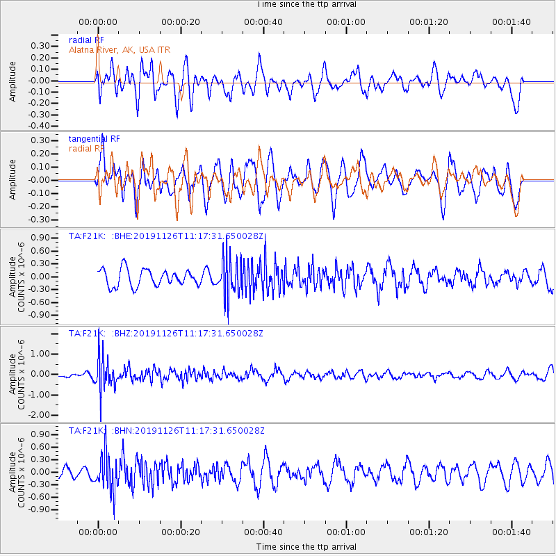
F21K Alatna River, AK, USA - Earthquake Result Viewer
*The percent match for this event was below the threshold and hence no stack was calculated.
| Earthquake location: |
Myanmar |
| Earthquake latitude/longitude: |
19.2/94.9 |
| Earthquake time(UTC): |
2019/11/26 (330) 11:05:57 GMT |
| Earthquake Depth: |
60 km |
| Earthquake Magnitude: |
5.4 Mww |
| Earthquake Catalog/Contributor: |
NEIC PDE/us |
|
| Network: |
TA USArray Transportable Network (new EarthScope stations) |
| Station: |
F21K Alatna River, AK, USA |
| Lat/Lon: |
67.22 N/153.48 W |
| Elevation: |
597 m |
|
| Distance: |
80.4 deg |
| Az: |
21.545 deg |
| Baz: |
296.991 deg |
| Ray Param: |
$rayparam |
*The percent match for this event was below the threshold and hence was not used in the summary stack. |
|
| Radial Match: |
65.500175 % |
| Radial Bump: |
400 |
| Transverse Match: |
55.660435 % |
| Transverse Bump: |
400 |
| SOD ConfigId: |
19951751 |
| Insert Time: |
2019-12-10 11:17:08.902 +0000 |
| GWidth: |
2.5 |
| Max Bumps: |
400 |
| Tol: |
0.001 |
|
Signal To Noise
| Channel | StoN | STA | LTA |
| TA:F21K: :BHZ:20191126T11:17:31.650028Z | 8.081908 | 8.365037E-7 | 1.0350325E-7 |
| TA:F21K: :BHN:20191126T11:17:31.650028Z | 2.4973128 | 4.3584572E-7 | 1.7452588E-7 |
| TA:F21K: :BHE:20191126T11:17:31.650028Z | 2.3326914 | 4.5425116E-7 | 1.9473264E-7 |
| Arrivals |
| Ps | |
| PpPs | |
| PsPs/PpSs | |


