You are here: Home > Network List > TA - USArray Transportable Network (new EarthScope stations) Stations List
> Station H16K Elim, AK, USA > Earthquake Result Viewer
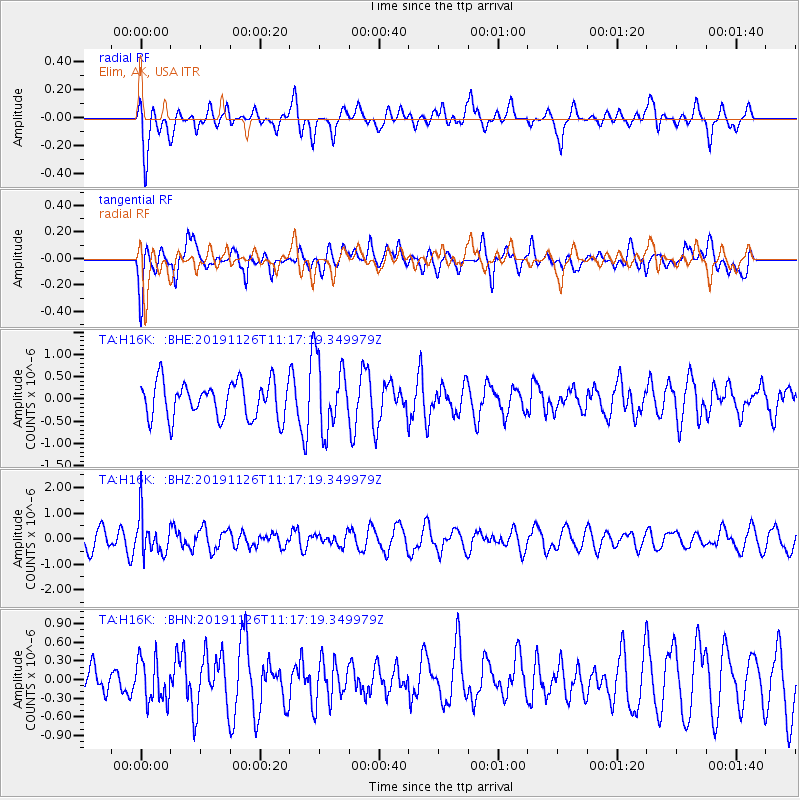
H16K Elim, AK, USA - Earthquake Result Viewer
*The percent match for this event was below the threshold and hence no stack was calculated.
| Earthquake location: |
Myanmar |
| Earthquake latitude/longitude: |
19.2/94.9 |
| Earthquake time(UTC): |
2019/11/26 (330) 11:05:57 GMT |
| Earthquake Depth: |
60 km |
| Earthquake Magnitude: |
5.4 Mww |
| Earthquake Catalog/Contributor: |
NEIC PDE/us |
|
| Network: |
TA USArray Transportable Network (new EarthScope stations) |
| Station: |
H16K Elim, AK, USA |
| Lat/Lon: |
64.64 N/162.24 W |
| Elevation: |
216 m |
|
| Distance: |
78.1 deg |
| Az: |
25.411 deg |
| Baz: |
289.72 deg |
| Ray Param: |
$rayparam |
*The percent match for this event was below the threshold and hence was not used in the summary stack. |
|
| Radial Match: |
58.815563 % |
| Radial Bump: |
400 |
| Transverse Match: |
51.957733 % |
| Transverse Bump: |
400 |
| SOD ConfigId: |
19951751 |
| Insert Time: |
2019-12-10 11:17:19.650 +0000 |
| GWidth: |
2.5 |
| Max Bumps: |
400 |
| Tol: |
0.001 |
|
Signal To Noise
| Channel | StoN | STA | LTA |
| TA:H16K: :BHZ:20191126T11:17:19.349979Z | 1.4953346 | 7.5348663E-7 | 5.0389167E-7 |
| TA:H16K: :BHN:20191126T11:17:19.349979Z | 0.9469879 | 3.4890007E-7 | 3.684314E-7 |
| TA:H16K: :BHE:20191126T11:17:19.349979Z | 1.9384774 | 7.8835524E-7 | 4.066879E-7 |
| Arrivals |
| Ps | |
| PpPs | |
| PsPs/PpSs | |


