You are here: Home > Network List > TA - USArray Transportable Network (new EarthScope stations) Stations List
> Station D28A Regan, ND, USA > Earthquake Result Viewer
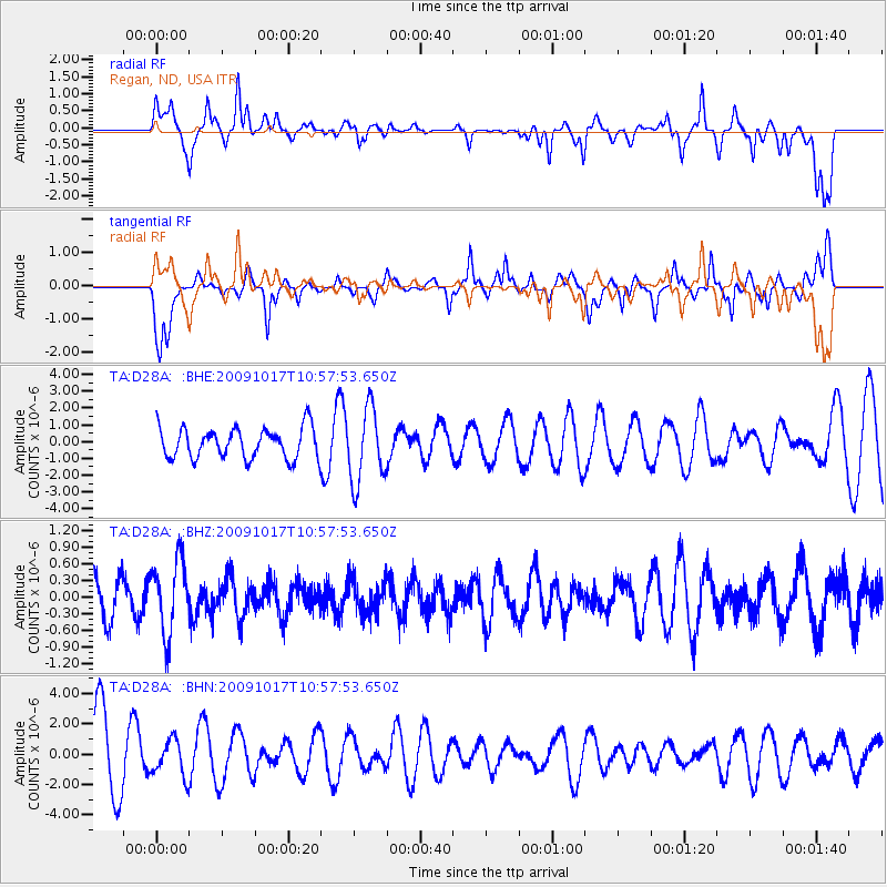
D28A Regan, ND, USA - Earthquake Result Viewer
*The percent match for this event was below the threshold and hence no stack was calculated.
| Earthquake location: |
Samoa Islands Region |
| Earthquake latitude/longitude: |
-16.4/-172.0 |
| Earthquake time(UTC): |
2009/10/17 (290) 10:45:26 GMT |
| Earthquake Depth: |
10 km |
| Earthquake Magnitude: |
5.7 MB, 5.3 MS, 5.7 MW, 5.7 MW |
| Earthquake Catalog/Contributor: |
WHDF/NEIC |
|
| Network: |
TA USArray Transportable Network (new EarthScope stations) |
| Station: |
D28A Regan, ND, USA |
| Lat/Lon: |
47.19 N/100.57 W |
| Elevation: |
621 m |
|
| Distance: |
89.8 deg |
| Az: |
40.273 deg |
| Baz: |
245.499 deg |
| Ray Param: |
$rayparam |
*The percent match for this event was below the threshold and hence was not used in the summary stack. |
|
| Radial Match: |
65.552124 % |
| Radial Bump: |
380 |
| Transverse Match: |
63.600574 % |
| Transverse Bump: |
400 |
| SOD ConfigId: |
2622 |
| Insert Time: |
2010-03-07 06:17:31.161 +0000 |
| GWidth: |
2.5 |
| Max Bumps: |
400 |
| Tol: |
0.001 |
|
Signal To Noise
| Channel | StoN | STA | LTA |
| TA:D28A: :BHZ:20091017T10:57:53.650Z | 1.6976237 | 6.6550854E-7 | 3.9202357E-7 |
| TA:D28A: :BHN:20091017T10:57:53.650Z | 0.36984557 | 1.18721E-6 | 3.2100156E-6 |
| TA:D28A: :BHE:20091017T10:57:53.650Z | 2.4205127 | 2.1930364E-6 | 9.0602146E-7 |
| Arrivals |
| Ps | |
| PpPs | |
| PsPs/PpSs | |


