You are here: Home > Network List > TA - USArray Transportable Network (new EarthScope stations) Stations List
> Station D28A Regan, ND, USA > Earthquake Result Viewer
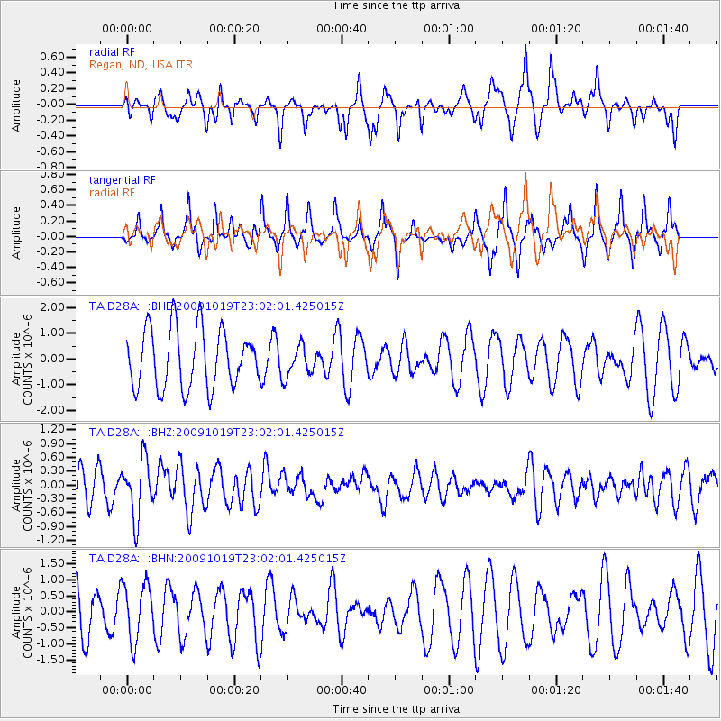
D28A Regan, ND, USA - Earthquake Result Viewer
*The percent match for this event was below the threshold and hence no stack was calculated.
| Earthquake location: |
Samoa Islands Region |
| Earthquake latitude/longitude: |
-15.4/-172.3 |
| Earthquake time(UTC): |
2009/10/19 (292) 22:49:38 GMT |
| Earthquake Depth: |
18 km |
| Earthquake Magnitude: |
6.2 MB, 5.7 MS, 6.0 MW, 5.9 MW |
| Earthquake Catalog/Contributor: |
WHDF/NEIC |
|
| Network: |
TA USArray Transportable Network (new EarthScope stations) |
| Station: |
D28A Regan, ND, USA |
| Lat/Lon: |
47.19 N/100.57 W |
| Elevation: |
621 m |
|
| Distance: |
89.2 deg |
| Az: |
40.356 deg |
| Baz: |
246.349 deg |
| Ray Param: |
$rayparam |
*The percent match for this event was below the threshold and hence was not used in the summary stack. |
|
| Radial Match: |
38.338493 % |
| Radial Bump: |
283 |
| Transverse Match: |
51.71097 % |
| Transverse Bump: |
262 |
| SOD ConfigId: |
2622 |
| Insert Time: |
2010-03-07 06:17:32.382 +0000 |
| GWidth: |
2.5 |
| Max Bumps: |
400 |
| Tol: |
0.001 |
|
Signal To Noise
| Channel | StoN | STA | LTA |
| TA:D28A: :BHZ:20091019T23:02:01.425015Z | 2.0546513 | 6.2836375E-7 | 3.05825E-7 |
| TA:D28A: :BHN:20091019T23:02:01.425015Z | 1.5204744 | 8.753986E-7 | 5.7574044E-7 |
| TA:D28A: :BHE:20091019T23:02:01.425015Z | 0.52200276 | 5.953183E-7 | 1.1404504E-6 |
| Arrivals |
| Ps | |
| PpPs | |
| PsPs/PpSs | |


