
PAS Pasadena, California, USA - Earthquake Result Viewer
| ||||||||||||||||||
| ||||||||||||||||||
| ||||||||||||||||||
|
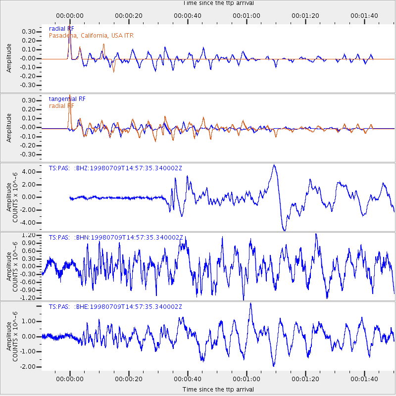
Signal To Noise
| Channel | StoN | STA | LTA |
| TS:PAS: :BHN:19980709T14:57:35.340002Z | 1.6912947 | 2.6106764E-7 | 1.5435964E-7 |
| TS:PAS: :BHE:19980709T14:57:35.340002Z | 1.5803393 | 2.0797253E-7 | 1.3159993E-7 |
| TS:PAS: :BHZ:19980709T14:57:35.340002Z | 7.1276503 | 7.742763E-7 | 1.08629955E-7 |
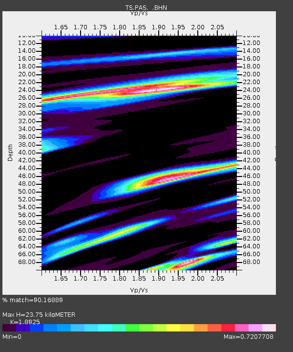
| Arrivals | |
| Ps | 3.5 SECOND |
| PpPs | 11 SECOND |
| PsPs/PpSs | 15 SECOND |

