You are here: Home > Network List > US - United States National Seismic Network Stations List
> Station DGMT Dagmar, Montana, USA > Earthquake Result Viewer
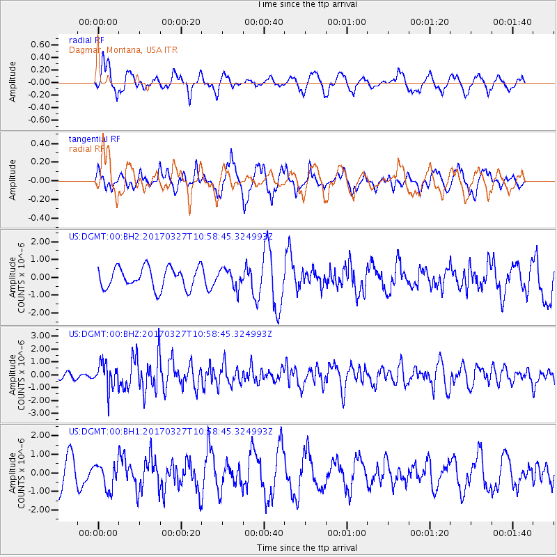
DGMT Dagmar, Montana, USA - Earthquake Result Viewer
*The percent match for this event was below the threshold and hence no stack was calculated.
| Earthquake location: |
Near Islands, Aleutian Islands |
| Earthquake latitude/longitude: |
52.8/172.2 |
| Earthquake time(UTC): |
2017/03/27 (086) 10:50:19 GMT |
| Earthquake Depth: |
10 km |
| Earthquake Magnitude: |
6.1 Mww |
| Earthquake Catalog/Contributor: |
NEIC PDE/us |
|
| Network: |
US United States National Seismic Network |
| Station: |
DGMT Dagmar, Montana, USA |
| Lat/Lon: |
48.47 N/104.20 W |
| Elevation: |
0.0 m |
|
| Distance: |
50.4 deg |
| Az: |
59.195 deg |
| Baz: |
308.401 deg |
| Ray Param: |
$rayparam |
*The percent match for this event was below the threshold and hence was not used in the summary stack. |
|
| Radial Match: |
53.17656 % |
| Radial Bump: |
400 |
| Transverse Match: |
47.184082 % |
| Transverse Bump: |
393 |
| SOD ConfigId: |
2028011 |
| Insert Time: |
2017-04-10 10:59:09.905 +0000 |
| GWidth: |
2.5 |
| Max Bumps: |
400 |
| Tol: |
0.001 |
|
Signal To Noise
| Channel | StoN | STA | LTA |
| US:DGMT:00:BHZ:20170327T10:58:45.324993Z | 3.2293267 | 1.0544667E-6 | 3.2652835E-7 |
| US:DGMT:00:BH1:20170327T10:58:45.324993Z | 0.76376027 | 6.957012E-7 | 9.108895E-7 |
| US:DGMT:00:BH2:20170327T10:58:45.324993Z | 0.9139661 | 5.367468E-7 | 5.8727215E-7 |
| Arrivals |
| Ps | |
| PpPs | |
| PsPs/PpSs | |


