You are here: Home > Network List > TA - USArray Transportable Network (new EarthScope stations) Stations List
> Station B30A Myrvik Farm, Edmore, ND, USA > Earthquake Result Viewer
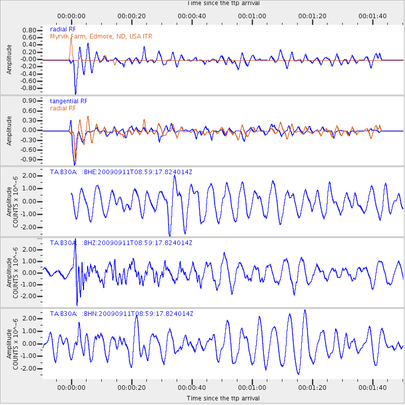
B30A Myrvik Farm, Edmore, ND, USA - Earthquake Result Viewer
*The percent match for this event was below the threshold and hence no stack was calculated.
| Earthquake location: |
Kuril Islands |
| Earthquake latitude/longitude: |
48.3/154.2 |
| Earthquake time(UTC): |
2009/09/11 (254) 08:49:11 GMT |
| Earthquake Depth: |
35 km |
| Earthquake Magnitude: |
5.8 MB, 5.0 MS, 5.6 MW, 5.6 MW |
| Earthquake Catalog/Contributor: |
WHDF/NEIC |
|
| Network: |
TA USArray Transportable Network (new EarthScope stations) |
| Station: |
B30A Myrvik Farm, Edmore, ND, USA |
| Lat/Lon: |
48.45 N/98.33 W |
| Elevation: |
480 m |
|
| Distance: |
65.0 deg |
| Az: |
44.478 deg |
| Baz: |
315.349 deg |
| Ray Param: |
$rayparam |
*The percent match for this event was below the threshold and hence was not used in the summary stack. |
|
| Radial Match: |
61.888554 % |
| Radial Bump: |
400 |
| Transverse Match: |
63.79458 % |
| Transverse Bump: |
400 |
| SOD ConfigId: |
2622 |
| Insert Time: |
2010-03-07 06:19:26.990 +0000 |
| GWidth: |
2.5 |
| Max Bumps: |
400 |
| Tol: |
0.001 |
|
Signal To Noise
| Channel | StoN | STA | LTA |
| TA:B30A: :BHZ:20090911T08:59:17.824014Z | 1.7798208 | 1.2394524E-6 | 6.963917E-7 |
| TA:B30A: :BHN:20090911T08:59:17.824014Z | 0.82194465 | 7.9221945E-7 | 9.638355E-7 |
| TA:B30A: :BHE:20090911T08:59:17.824014Z | 1.7591947 | 1.297992E-6 | 7.3783303E-7 |
| Arrivals |
| Ps | |
| PpPs | |
| PsPs/PpSs | |


