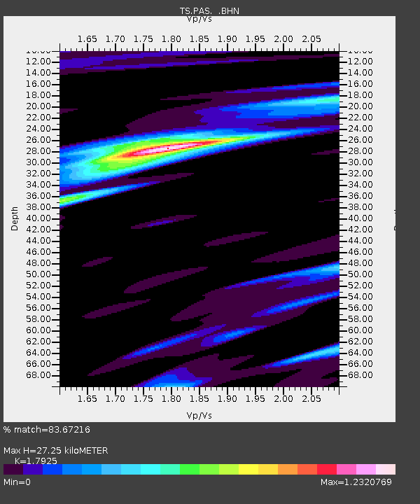
PAS Pasadena, California, USA - Earthquake Result Viewer

Earthquake location: Near East Coast Of Honshu, Japan
Earthquake latitude/longitude: 38.1/142.1
Earthquake time(UTC): 2005/12/02 (336) 13:13:09 GMT
Earthquake Depth: 29 km
Earthquake Magnitude: 6.1 MB, 6.3 MS, 6.5 MW, 6.4 MW
Earthquake Catalog/Contributor: WHDF/NEIC
Network: TS TERRAscope (Southern California Seismic Network)
Station: PAS Pasadena, California, USA
Lat/Lon: 34.15 N/118.17 W
Elevation: 295 m
Distance: 76.5 deg
Az: 57.202 deg
Baz: 306.893 deg
Ray Param: 0.05089397
Estimated Moho Depth: 27.25 km
Estimated Crust Vp/Vs: 1.79
Assumed Crust Vp: 6.1 km/s
Estimated Crust Vs: 3.403 km/s
Estimated Crust Poisson's Ratio: 0.27
Radial Match: 83.67216 %
Radial Bump: 400
Transverse Match: 75.47961 %
Transverse Bump: 400
SOD ConfigId: 2564
Insert Time: 2010-02-26 14:37:10.295 +0000
GWidth: 2.5
Max Bumps: 400
Tol: 0.001

Signal To Noise

ChannelStoNSTALTA
TS:PAS: :BHN:20051202T13:24:25.78001Z2.1796415.2252017E-72.3972763E-7
TS:PAS: :BHE:20051202T13:24:25.78001Z0.9727921.7696274E-71.8191221E-7
TS:PAS: :BHZ:20051202T13:24:25.78001Z3.94463447.1768375E-71.8193923E-7
Arrivals
Ps3.6 SECOND
PpPs12 SECOND
PsPs/PpSs16 SECOND