PAS Pasadena, California, USA - Earthquake Result Viewer
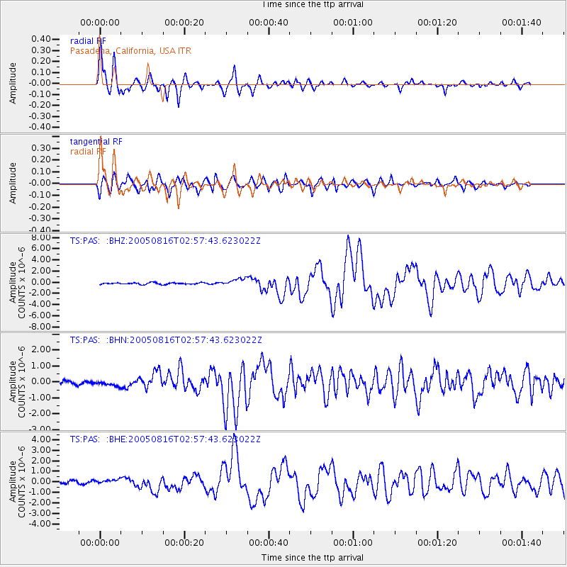
Earthquake location: Near East Coast Of Honshu, Japan
Earthquake latitude/longitude: 38.3/142.0
Earthquake time(UTC): 2005/08/16 (228) 02:46:28 GMT
Earthquake Depth: 36 km
Earthquake Magnitude: 6.5 MB, 6.8 MS, 7.2 MW, 7.1 MW
Earthquake Catalog/Contributor: WHDF/NEIC
Network: TS TERRAscope (Southern California Seismic Network)
Station: PAS Pasadena, California, USA
Lat/Lon: 34.15 N/118.17 W
Elevation: 295 m
Distance: 76.5 deg
Az: 57.197 deg
Baz: 307.091 deg
Ray Param: 0.050909378
Estimated Moho Depth: 28.5 km
Estimated Crust Vp/Vs: 1.75
Assumed Crust Vp: 6.1 km/s
Estimated Crust Vs: 3.496 km/s
Estimated Crust Poisson's Ratio: 0.26
Radial Match: 96.07114 %
Radial Bump: 394
Transverse Match: 89.256584 %
Transverse Bump: 400
SOD ConfigId: 2564
Insert Time: 2010-02-26 14:37:17.202 +0000
GWidth: 2.5
Max Bumps: 400
Tol: 0.001

Signal To Noise

ChannelStoNSTALTA
TS:PAS: :BHN:20050816T02:57:43.623022Z1.52652721.8297123E-71.1986111E-7
TS:PAS: :BHE:20050816T02:57:43.623022Z2.1407342.4876792E-71.16206834E-7
TS:PAS: :BHZ:20050816T02:57:43.623022Z4.78695776.757126E-71.41157E-7
Arrivals
Ps3.6 SECOND
PpPs12 SECOND
PsPs/PpSs16 SECOND